2024 Map of Kraemer
USGS Topo · Published 2024About this map
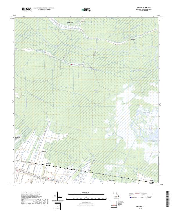
Rathborne Swamp dominates the center of this landscape, illustrating the intricate relationship between the Louisiana wetlands and the communities built along their margins. The map captures the distinct settlement patterns of Lafourche Parish, where development follows the higher ground of natural levees and plantation boundaries. Historical agricultural footprints are evident at Melodia Plantation and the fields surrounding Ewing, while the southern edge of the sheet is defined by the winding course of Bayou Lafourche and the established hub of Raceland. A dense network of drainage canals, including the Pitre-Lening Canal and Theriot Canal, reveals the engineered efforts to manage the water-bound terrain. From the northern hamlets of Chackbay and Kraemer to the small airfield at Theriot Field, this survey documents the modern infrastructure and historic land divisions that characterize this portion of the bayou country.
Find a feature on this map
43 named features on this map. Tap any name to fly to it.
Don’t see what you’re looking for? This feature index may not catch every label — zoom into the map to look around manually.
Map Details
Editions of this 2024 Kraemer Map
This is the sole edition of this map. No revisions or reprints were ever made.