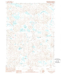
1989 Map of Krause Lake East
USGS Topo · Published 1989About this map
Sheridan County's high plains terrain is defined by a dense concentration of alkali lakes and seasonal wetlands in this late-twentieth-century study. The landscape is characterized by its numerous named water bodies, including Long Lake, Krause Lake, and the cluster known as the Wilkinson Lakes. The presence of School Section Lake and the nearby School Section Lakes points to the early reservation of land for educational funding, a common feature of western township planning.
Find a feature on this map
16 named features on this map. Tap any name to fly to it.
Don’t see what you’re looking for? This feature index may not catch every label — zoom into the map to look around manually.
Map Details
Editions of this 1989 Krause Lake East Map
This is the sole edition of this map. No revisions or reprints were ever made.
Other maps of this area

1948 · Antioch
USGS Topo · 1:62,500

1948 · Lakeside
USGS Topo · 1:62,500

1948 · Twin Lakes
USGS Topo · 1:62,500

1949 · Antioch
USGS Topo · 1:62,500

1950 · Twin Lakes
USGS Topo · 1:62,500

1950 · Lakeside
USGS Topo · 1:62,500

1950 · Skunk Lake
USGS Topo · 1:62,500

1955 · Alliance
USGS Topo · 1:250,000

1957 · Alliance
USGS Topo · 1:250,000

1958 · Alliance
USGS Topo · 1:250,000