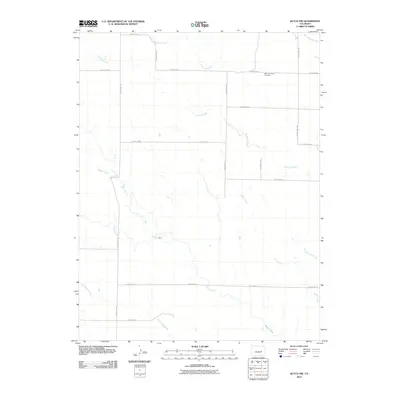
2010 Map of Kutch NW
USGS Topo · Published 2010About this map
Mountain View Cemetery sits along the northern reaches of this Elbert County landscape, serving as a primary landmark in an area defined by its drainage network. The terrain is shaped by several seasonal watercourses, most notably the wide paths of Horse Creek and Mustang Creek, which weave through a grid of rural county roads. A strictly organized transportation system is evident through the placement of routes like County Hwy-189 and County Rd-10, which delineate the high plains. The distribution of these roads alongside features such as Skull Creek and Adobe Creek illustrates a classic Western pattern of land division, where early section lines dictated the modern movement of people and commerce through the ranching country of eastern Colorado.
Find a feature on this map
21 named features on this map. Tap any name to fly to it.
Don’t see what you’re looking for? This feature index may not catch every label — zoom into the map to look around manually.
Map Details
Editions of this 2010 Kutch NW Map
This is the sole edition of this map. No revisions or reprints were ever made.
Other maps of this area

1889 · Sanborn
USGS Topo · 1:125,000

1891 · Sanborn
USGS Topo · 1:125,000

1891 · Limon
USGS Topo · 1:125,000

1892 · Limon
USGS Topo · 1:125,000

1893 · Sanborn
USGS Topo · 1:125,000

1893 · Big Springs
USGS Topo · 1:125,000

1953 · Denver
USGS Topo · 1:250,000

1954 · Limon
USGS Topo · 1:250,000

1954 · Lamar
USGS Topo · 1:250,000

1954 · Pueblo
USGS Topo · 1:250,000