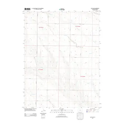
2013 Map of Kutch NW
USGS Topo · Published 2013About this map
Antelope Cr and Mustang Cr carve through this high plains landscape of Elbert County, defining a drainage pattern that flows generally southeast toward the Arkansas River basin. The area is characterized by an extensive network of rural routes, including CO Road 149 and CO Road 34, which follow the section lines of the Public Land Survey System. The presence of Mtn View Cem in the northern portion of the map suggests a point of local historical and genealogical significance for the surrounding ranching community. The terrain is marked by seasonal watercourses such as Adobe Cr, Horse Cr, and Skull Cr, whose ephemeral flows have shaped the broad, shallow valleys of this semi-arid region. These geographic features illustrate the persistent reliance on natural drainage and a grid-based road system in a landscape largely dedicated to open-range agriculture and ranching.
Find a feature on this map
25 named features on this map. Tap any name to fly to it.
Don’t see what you’re looking for? This feature index may not catch every label — zoom into the map to look around manually.
Map Details
Editions of this 2013 Kutch NW Map
This is the sole edition of this map. No revisions or reprints were ever made.
Other maps of this area

1889 · Sanborn
USGS Topo · 1:125,000

1891 · Sanborn
USGS Topo · 1:125,000

1891 · Limon
USGS Topo · 1:125,000

1892 · Limon
USGS Topo · 1:125,000

1893 · Sanborn
USGS Topo · 1:125,000

1893 · Big Springs
USGS Topo · 1:125,000

1953 · Denver
USGS Topo · 1:250,000

1954 · Limon
USGS Topo · 1:250,000

1954 · Lamar
USGS Topo · 1:250,000

1954 · Pueblo
USGS Topo · 1:250,000