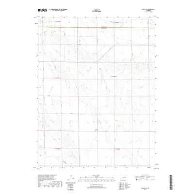
2019 Map of Kutch SE
USGS Topo · Published 2019About this map
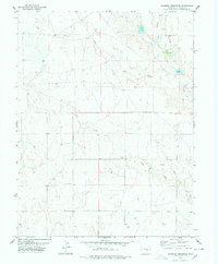
The High Plains of eastern Colorado define this 2019 survey, where the administrative boundary between Elbert Co and Lincoln Co cuts across a landscape dominated by intermittent drainage systems. The Horse Cr basin and its tributaries, including Little Horse Cr and Pats Draw, carve subtle relief into the terrain as they flow toward the southeast. This area is characterized by its rural grid of county roads, such as Co RD 14 and Co RD V, which serve the expansive agricultural and ranching lands of the region. A significant historical landmark is the Liberty Bell Cem, located near the intersection of several section lines, providing a central point for genealogical interest in an otherwise sparsely populated territory. Further north, the headwaters of Lone Tree Cr and Mustang Cr emerge, illustrating the intricate hydrography that dictates the settlement and movement patterns of the plains.
Find a feature on this map
28 named features on this map. Tap any name to fly to it.
Don’t see what you’re looking for? This feature index may not catch every label — zoom into the map to look around manually.
Map Details
Editions of this 2019 Kutch SE Map
This is the sole edition of this map. No revisions or reprints were ever made.
Other maps of this area

1889 · Sanborn
USGS Topo · 1:125,000

1891 · Sanborn
USGS Topo · 1:125,000

1893 · Sanborn
USGS Topo · 1:125,000

1954 · Lamar
USGS Topo · 1:250,000

1958 · Lamar
USGS Topo · 1:250,000
1975 · Kutch
USGS Topo · 1:24,000

1977 · Punkin Center
USGS Topo · 1:24,000
1978 · Peace Valley
USGS Topo · 1:24,000
1978 · Kutch NW
USGS Topo · 1:24,000
1978 · Sanborn Reservoir
USGS Topo · 1:24,000