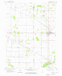
1958 Map of La Crosse
USGS Topo · Published 1976About this map
The railroad junction at La Crosse serves as the central hub of this 1950s Indiana landscape, where multiple major rail lines converge. The Pennsylvania Railroad, Chesapeake and Ohio, Erie Railroad, and Monon Railroad intersect here, reflecting the heavy industrial and transit network of the era. This concentration of trackage supported smaller outlying settlements such as Clanricarde, Wilders, and Riverside, the latter situated near the winding Kankakee River at the southern boundary.
Find a feature on this map
40 named features on this map. Tap any name to fly to it.
Don’t see what you’re looking for? This feature index may not catch every label — zoom into the map to look around manually.
Map Details
Editions of this 1958 La Crosse Map
2 editions found
Other maps of this area

1953 · Wanatah
USGS Topo · 1:24,000

1953 · Valparaiso
USGS Topo · 1:24,000

1953 · Kouts
USGS Topo · 1:24,000

1953 · Chicago
USGS Topo · 1:250,000

1957 · Chicago
USGS Topo · 1:250,000

1957 · Wheatfield
USGS Topo · 1:24,000

1958 · La Crosse
USGS Topo · 1:24,000

1958 · Hanna
USGS Topo · 1:24,000

1959 · English Lake
USGS Topo · 1:24,000

1959 · North Judson
USGS Topo · 1:24,000