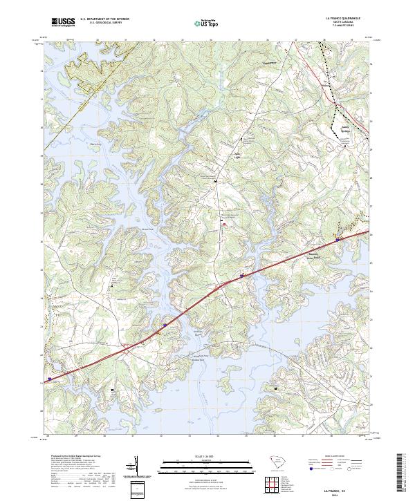
2024 Map of La France
USGS Topo · Published 2024About this map
The Seneca River and the expansive Hartwell Lake dominate this Anderson County landscape, where the confluence of several major creeks shapes the local topography. Historic church grounds and family burial sites are frequent landmarks across the terrain, including Mount Zion Presbyterian Graveyard near Sandy Springs and Mount Tabor Baptist Church Graveyard in the vicinity of New Light. The map documents the persistent industrial and transit corridors of the region, notably the CSX Transportation line passing through the mill town of La France.
Find a feature on this map
217 named features on this map. Tap any name to fly to it.
Don’t see what you’re looking for? This feature index may not catch every label — zoom into the map to look around manually.
Map Details
Editions of this 2024 La France Map
This is the sole edition of this map. No revisions or reprints were ever made.
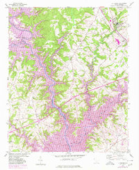
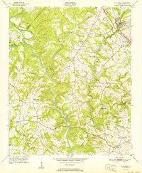
Historical Maps of Leisure Village Through Time
3 maps found