
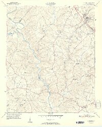
1951 Map of La France
USGS Topo · Published 1951About this map
The Seneca River winds through the heart of this Piedmont landscape, defining the boundary between Oconee and Anderson counties before reaching the Portman Dam. At the start of the 1950s, this area was characterized by a dense network of rural community centers, each anchored by a schoolhouse or church. Settlements like La France and Sandy Springs serve as focal points in the northeast, while the interior is dotted with numerous family and community landmarks such as Asbury Clark Memorial Ch and the New Light Sch.
Find a feature on this map
47 named features on this map. Tap any name to fly to it.
Don’t see what you’re looking for? This feature index may not catch every label — zoom into the map to look around manually.
Map Details
Editions of this 1951 La France Map
2 editions found
Other maps of this area

1888 · Pickens
USGS Topo · 1:125,000

1893 · Elberton
USGS Topo · 1:125,000

1894 · Pickens
USGS Topo · 1:125,000

1950 · La France
USGS Topo · 1:24,000

1951 · Clemson
USGS Topo · 1:24,000

1954 · Greenville
USGS Topo · 1:250,000

1957 · Anderson
USGS Topo · 1:62,500

1958 · Greenville
USGS Topo · 1:250,000

1958 · Seneca
USGS Topo · 1:24,000

1958 · Fair Play
USGS Topo · 1:24,000