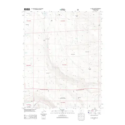
2013 Map of La Jara Canyon
USGS Topo · Published 2013About this map
Braiden Cow Camp sits at the heart of this high-elevation landscape, reflecting the long-standing ranching traditions within the Rio Grande National Forest. The terrain is defined by a series of significant drainages and reservoirs, most notably La Jara Reservoir and Bluebird Reservoir, which anchor the northern half of the territory. The complex hydrology of the area is further evidenced by the Chicago Bogs and La Grulla Lake, alongside the steady flow of the Conejos River in the south.
Find a feature on this map
38 named features on this map. Tap any name to fly to it.
Don’t see what you’re looking for? This feature index may not catch every label — zoom into the map to look around manually.
Map Details
Editions of this 2013 La Jara Canyon Map
This is the sole edition of this map. No revisions or reprints were ever made.
Other maps of this area

1922 · Conejos
USGS Topo · 1:125,000

1945 · Durango
USGS Topo · 1:250,000

1953 · Durango
USGS Topo · 1:250,000

1954 · Durango
USGS Topo · 1:250,000

1961 · Durango
USGS Topo · 1:250,000

1963 · Durango
USGS Topo · 1:250,000

1966 · Durango
USGS Topo · 1:250,000
1967 · Osier
USGS Topo · 1:24,000
1967 · Spectacle Lake
USGS Topo · 1:24,000
1967 · La Jara Canyon
USGS Topo · 1:24,000