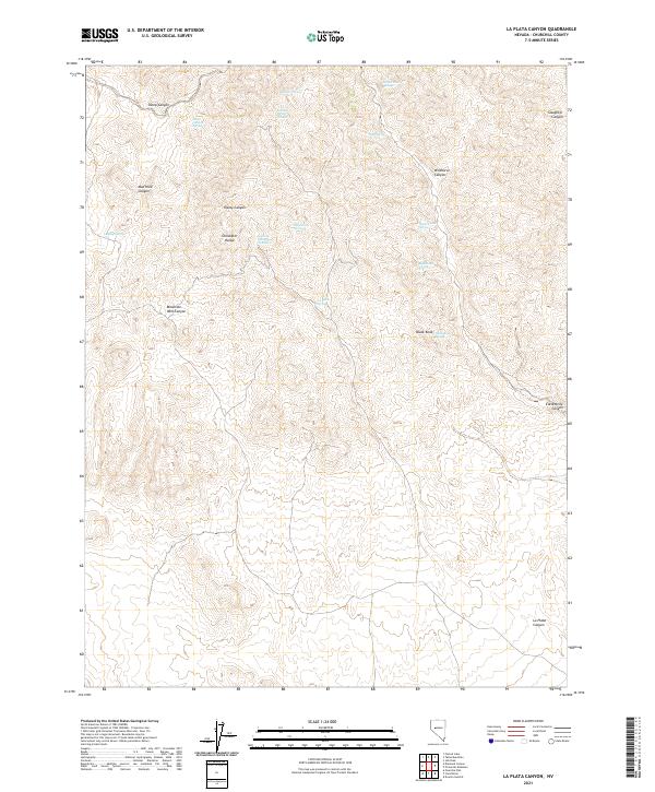
2021 Map of La Plata Canyon
USGS Topo · Published 2021About this map
The Stillwater Range dominates this portion of Churchill County, Nevada, where the high desert terrain is punctuated by a network of seasonal water sources and deep ravines. The landscape's hydrology is marked by numerous named springs that once served as critical waypoints, such as Ripley Spring, Black Knob Spring, and the curiously named Burnt Cabin Spring. These water points are scattered across a complex topography of drainage systems, including Mountain Well Canyon and the prominent La Plata Canyon to the southeast.
Find a feature on this map
26 named features on this map. Tap any name to fly to it.
Don’t see what you’re looking for? This feature index may not catch every label — zoom into the map to look around manually.
Map Details
Editions of this 2021 La Plata Canyon Map
This is the sole edition of this map. No revisions or reprints were ever made.
Other maps of this area

1908 · Carson Sink
USGS Topo · 1:250,000

1910 · Carson Sink
USGS Topo · 1:250,000

1957 · Reno
USGS Topo · 1:250,000

1959 · Reno
USGS Topo · 1:250,000

1960 · Reno
USGS Topo · 1:250,000

1969 · Table Mtn
USGS Topo · 1:24,000

1969 · Foxtail Lake
USGS Topo · 1:24,000

1972 · Pirouette Mtn
USGS Topo · 1:24,000

1972 · Fourmile Flat
USGS Topo · 1:24,000
1972 · Job Peak
USGS Topo · 1:24,000