
1969 Map of Foxtail Lake
USGS Topo · Published 1972About this map
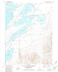
Stillwater Marsh and a complex network of wetlands dominate this Nevada landscape, reflecting the intricate water management of the high desert in the late 1960s. The map illustrates a transitional environment where the Stillwater National Wildlife Refuge meets the stark Alkali Flat. Human intervention in this hydrologic system is visible through features like West Drain, East Canal, and the Stillwater Reservoir, which support diverse habitats such as Foxtail Lake and Goose Lake. Local land use is noted by remote outposts like Rice Landing and the East Pasture Corral. To the south, the terrain shifts abruptly as the flats give way to the steep relief of the Stillwater Point and the drainages of Mountain Well Canyon and Shirttail Canyon, marking the edge of the desert basin floor.
Find a feature on this map
38 named features on this map. Tap any name to fly to it.
Don’t see what you’re looking for? This feature index may not catch every label — zoom into the map to look around manually.
Map Details
Editions of this 1969 Foxtail Lake Map
2 editions found
Other maps of this area

1908 · Carson Sink
USGS Topo · 1:250,000

1910 · Carson Sink
USGS Topo · 1:250,000

1950 · Stillwater
USGS Topo · 1:62,500

1951 · Carson Lake
USGS Topo · 1:62,500

1957 · Reno
USGS Topo · 1:250,000

1959 · Reno
USGS Topo · 1:250,000

1960 · Reno
USGS Topo · 1:250,000

1969 · Cox Canyon
USGS Topo · 1:24,000

1969 · Table Mtn
USGS Topo · 1:24,000

1969 · Pintail Bay
USGS Topo · 1:24,000