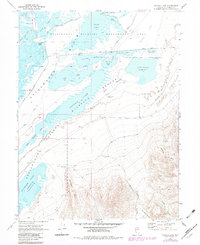
1969 Map of Foxtail Lake
USGS Topo · Published 1983About this map
Stillwater Marsh dominates this desert wetland environment, showing a complex network of alkali flats and managed water bodies in the late 1960s. The map illustrates an intricate system of water control including the Siphon Canal, Division Lake, and West Drain, which support the varied ecosystems of the Stillwater National Wildlife Refuge. Remote outposts such as the Navy Cabin and shoreline features like Goose Landing and Rice Landing provide evidence of early human activity and access points within these brackish basins.
Find a feature on this map
43 named features on this map. Tap any name to fly to it.
Don’t see what you’re looking for? This feature index may not catch every label — zoom into the map to look around manually.
Map Details
Editions of this 1969 Foxtail Lake Map
2 editions found

Other maps of this area

1908 · Carson Sink
USGS Topo · 1:250,000

1910 · Carson Sink
USGS Topo · 1:250,000

1950 · Stillwater
USGS Topo · 1:62,500

1951 · Carson Lake
USGS Topo · 1:62,500

1957 · Reno
USGS Topo · 1:250,000

1959 · Reno
USGS Topo · 1:250,000

1960 · Reno
USGS Topo · 1:250,000

1969 · Cox Canyon
USGS Topo · 1:24,000

1969 · Table Mtn
USGS Topo · 1:24,000

1969 · Pintail Bay
USGS Topo · 1:24,000