
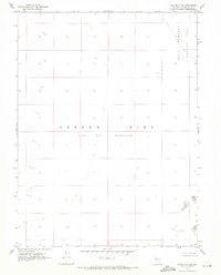
1969 Map of Pintail Bay
USGS Topo · Published 1972About this map
The Stillwater Wildlife Management Area dominates this section of the Nevada desert, where the terminal drainage of the Carson River creates a complex system of wetlands and alkali flats. This 1968 survey details a hydraulic landscape defined by the Carson Sink and a series of interconnected basins including Willow Lake, Stillwater Lake, and the expansive Swan Lake Marsh. Several specific landings, such as South Swan Landing and Conradts Landing, indicate localized access points for hunters and naturalists within the marshy terrain.
Find a feature on this map
30 named features on this map. Tap any name to fly to it.
Don’t see what you’re looking for? This feature index may not catch every label — zoom into the map to look around manually.
Map Details
Editions of this 1969 Pintail Bay Map
This is the sole edition of this map. No revisions or reprints were ever made.
Other maps of this area

1908 · Carson Sink
USGS Topo · 1:250,000

1910 · Carson Sink
USGS Topo · 1:250,000

1950 · Stillwater
USGS Topo · 1:62,500

1951 · Carson Sink
USGS Topo · 1:62,500

1957 · Reno
USGS Topo · 1:250,000

1959 · Reno
USGS Topo · 1:250,000

1960 · Reno
USGS Topo · 1:250,000
1969 · Lone Rock SW
USGS Topo · 1:24,000

1969 · Cox Canyon
USGS Topo · 1:24,000

1969 · Table Mtn
USGS Topo · 1:24,000