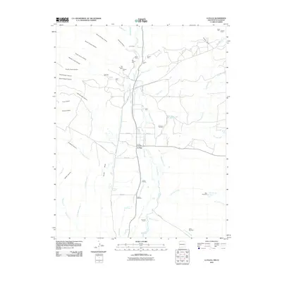
2010 Map of La Plata
USGS Topo · Published 2010About this map
The La Plata River valley serves as the central artery for this high-desert landscape, where a sophisticated network of irrigation ditches, including the Enterprise Ditch and Highland Park Ditch, supports local agriculture. The area is defined by its mining history, with family-named operations like the Morgan Mines, Bill Thomas Mine, and Fields Mine scattered across the surrounding arroyos and canyons. Settlement is concentrated around La Plata, where the La Plata Post Office and two nearby burial grounds, Greenhorn Cemetery and Laplata Cemetery, provide focal points for local history. To the west, the prominent Conger Mesa rises above Conger Lake, while the eastern terrain is marked by seasonal washes like McDermott Arroyo and infrastructure such as the Silver Pipe Dam.
Find a feature on this map
70 named features on this map. Tap any name to fly to it.
Don’t see what you’re looking for? This feature index may not catch every label — zoom into the map to look around manually.
Map Details
Editions of this 2010 La Plata Map
This is the sole edition of this map. No revisions or reprints were ever made.
Other maps of this area

1889 · Chaco
USGS Topo · 1:250,000

1892 · Chaco
USGS Topo · 1:250,000

1912 · Soda Canyon
USGS Topo · 1:62,500

1913 · Red Mesa
USGS Topo · 1:62,500

1915 · Soda Canyon
USGS Topo · 1:62,500

1954 · Shiprock
USGS Topo · 1:250,000

1956 · Cortez
USGS Topo · 1:250,000

1958 · Cortez
USGS Topo · 1:250,000

1958 · Shiprock
USGS Topo · 1:250,000

1959 · Shiprock
USGS Topo · 1:250,000