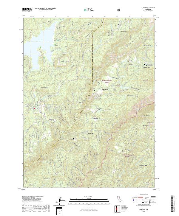
2022 Map of La Porte
USGS Topo · Published 2022About this map
La Porte and the surrounding high country of the Plumas National Forest and Tahoe National Forest reveal a landscape defined by its mining and timber history. Numerous cemeteries, including the Howland Flat Cem and Saint Louis Cem, are scattered across the ridges, marking the locations of 19th-century gold camps. The terrain is deeply incised by ravines like Sacketts Gulch and Deadwood Ravine, which drain into the Slate Cr system. Historical transit patterns are evident in the winding path of the Quincy La Porte Road and old routes like Stagecoach. Industrial activity is represented by the Moto Mine and Meredith Mill, while modern infrastructure includes the Little Grass Valley Reservoir and Little Table Rock Reservoir. Settlements such as Gibsonville and Queen City sit along prominent divides like Gibsonville Ridge and Port Wine Ridge, reflecting a settlement pattern dictated by the steep geography of the Sierra Nevada.
Find a feature on this map
99 named features on this map. Tap any name to fly to it.
Don’t see what you’re looking for? This feature index may not catch every label — zoom into the map to look around manually.
Map Details
Editions of this 2022 La Porte Map
This is the sole edition of this map. No revisions or reprints were ever made.
Other maps of this area

1888 · Bidwell Bar
USGS Topo · 1:125,000

1891 · Bidwell Bar
USGS Topo · 1:125,000

1891 · Downieville
USGS Topo · 1:125,000

1893 · Bidwell Bar
USGS Topo · 1:125,000

1893 · Downieville
USGS Topo · 1:125,000

1895 · Bidwell Bar
USGS Topo · 1:125,000

1895 · Downieville
USGS Topo · 1:125,000

1896 · Downieville
USGS Topo · 1:125,000

1897 · Bidwell Bar
USGS Topo · 1:125,000

1897 · Downieville
USGS Topo · 1:125,000