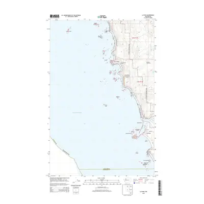
2014 Map of La Push
USGS Topo · Published 2014About this map
La Push stands at the confluence of the Quillayute River and the Pacific Ocean, serving as a central point where the land meets a complex archipelago of sea stacks and rocky outcrops. The map details a coastline defined by significant geological features, including the Quillayute Needles and the towering James Island guarding the entrance to the Quileute Marina. This 2014 survey documents the wilderness interface between the Olympic National Park and the coastal settlement, with the Pacific NW National Scenic Trail threading along the bluffs. Further north, the Chilean Memorial Monument at Cape Johnson serves as a reminder of the maritime history and hazards along this stretch of the Olympic Peninsula. The intricate shoreline transition from Rialto Beach to First Beach illustrates the specialized coastal geography of Clallam County, where landmarks like Hole-in-the-Wall and Cake Rock break the Pacific horizon.
Find a feature on this map
35 named features on this map. Tap any name to fly to it.
Don’t see what you’re looking for? This feature index may not catch every label — zoom into the map to look around manually.
Map Details
Editions of this 2014 La Push Map
This is the sole edition of this map. No revisions or reprints were ever made.
Other maps of this area

1935 · Ozette Lake
USGS Topo · 1:62,500

1942 · Ozette Lake
USGS Topo · 1:62,500

1943 · Copalis Beach
USGS Topo · 1:250,000

1951 · Copalis Beach
USGS Topo · 1:250,000

1953 · Cape Flattery
USGS Topo · 1:250,000

1956 · La Push
USGS Topo · 1:62,500

1956 · Ozette Lake
USGS Topo · 1:62,500

1957 · Copalis Beach
USGS Topo · 1:250,000

1963 · Copalis Beach
USGS Topo · 1:250,000

1963 · Cape Flattery
USGS Topo · 1:250,000