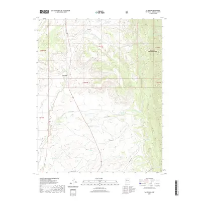
2020 Map of La Ventana
USGS Topo · Published 2020About this map
La Ventana sits at the heart of this high-desert landscape in Sandoval County, where the topography is defined by the northward flow of the Rio Puerco and the rugged canyons of the Santa Fe National Forest. The map detail reveals a complex network of seasonal drainages, including the Arroyo Veguita Blanca and the Rio Salado, carving through the arid terrain. For researchers, the transition between forest lands and tribal service routes is well-documented, with named corridors like Indian Svc Rte 95 and Indian Svc Rte 97 crisscrossing the mesa country. Natural water sources are scarce but critical, marked by isolated points like Thompson Spring and J Herrera Springs. This modern-era survey provides a precise look at the land use and hydrology of the region, showing how the primitive road system follows the natural contours of the arroyos.
Find a feature on this map
25 named features on this map. Tap any name to fly to it.
Don’t see what you’re looking for? This feature index may not catch every label — zoom into the map to look around manually.
Map Details
Editions of this 2020 La Ventana Map
This is the sole edition of this map. No revisions or reprints were ever made.
Other maps of this area

1883 · Mt. Taylor
USGS Topo · 1:250,000

1886 · Mt. Taylor
USGS Topo · 1:250,000

1890 · Jemes
USGS Topo · 1:125,000

1892 · Jemes
USGS Topo · 1:125,000

1892 · Mt. Taylor
USGS Topo · 1:250,000

1899 · Mt. Taylor
USGS Topo · 1:250,000

1939 · La Ventana
USGS Topo · 1:62,500

1939 · San Ysidro
USGS Topo · 1:62,500

1943 · San Ysidro
USGS Topo · 1:62,500

1943 · La Ventana
USGS Topo · 1:62,500