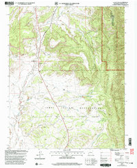
2002 Map of La Ventana
USGS Topo · Published 2003About this map
La Ventana occupies a critical junction where the Rio Puerco flows through high desert terrain, serving as a focal point for this 2002 revision. The landscape is defined by massive land divisions, including the Ojo Del Espiritu Santo Grant and the western edge of the Santa Fe National Forest. Evidence of local industry is visible through the Luciani Mines and San Miguel Mines, while numerous gravel pits dot the northern sections of the map.
Find a feature on this map
26 named features on this map. Tap any name to fly to it.
Don’t see what you’re looking for? This feature index may not catch every label — zoom into the map to look around manually.
Map Details
Editions of this 2002 La Ventana Map
This is the sole edition of this map. No revisions or reprints were ever made.
Other maps of this area

1883 · Mt. Taylor
USGS Topo · 1:250,000

1886 · Mt. Taylor
USGS Topo · 1:250,000

1890 · Jemes
USGS Topo · 1:125,000

1892 · Jemes
USGS Topo · 1:125,000

1892 · Mt. Taylor
USGS Topo · 1:250,000

1899 · Mt. Taylor
USGS Topo · 1:250,000

1939 · La Ventana
USGS Topo · 1:62,500

1939 · San Ysidro
USGS Topo · 1:62,500

1943 · San Ysidro
USGS Topo · 1:62,500

1943 · La Ventana
USGS Topo · 1:62,500