
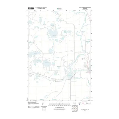
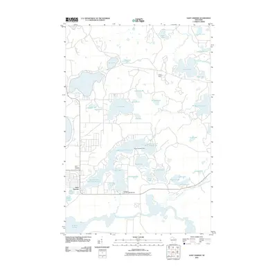
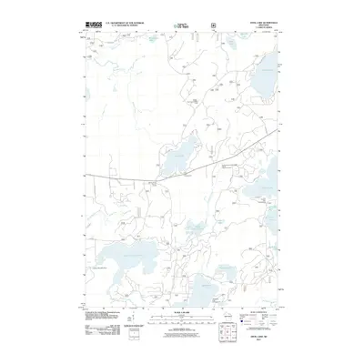
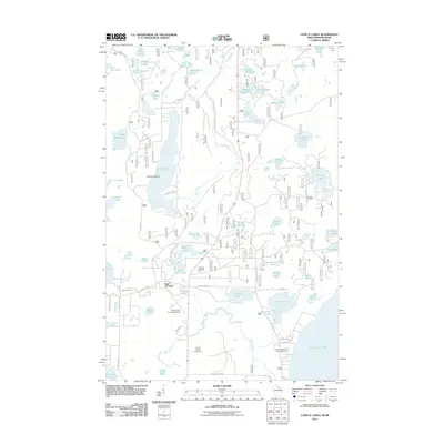
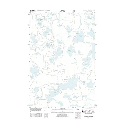
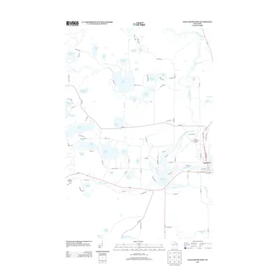
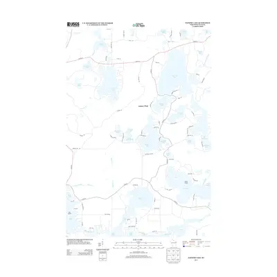
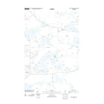
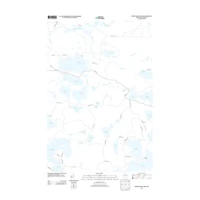
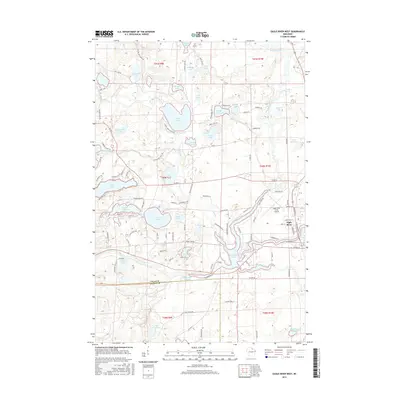
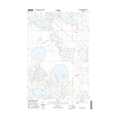
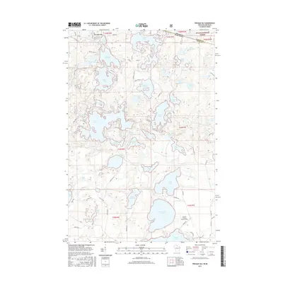
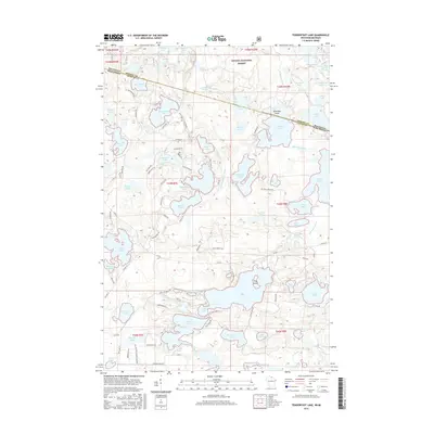
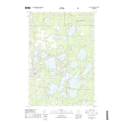
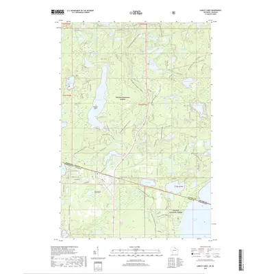
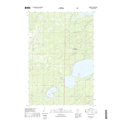
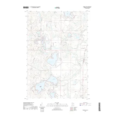
2005 Map of Lac Du Flambeau
USGS Topo · Published 2006About this map
The Lac du Flambeau Indian Reservation encompasses a vast complex of glacial water bodies, centered on the settlement of Lac du Flambeau. This landscape is defined by the intricate shorelines of Pokegama Lake, Interlaken Long Lake, and Crawling Stone Lake, which together form a central navigable waterway system. Significant local landmarks include Strawberry Island and various smaller lakes such as Broken Bow Lake and Tippecanoe Lake, showing the area's transition into a major regional recreation hub while maintaining its deep tribal heritage.
Find a feature on this map
49 named features on this map. Tap any name to fly to it.
Don’t see what you’re looking for? This feature index may not catch every label — zoom into the map to look around manually.
Map Details
Editions of this 2005 Lac Du Flambeau Map
This is the sole edition of this map. No revisions or reprints were ever made.
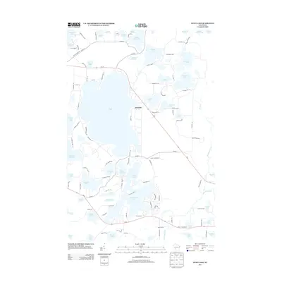
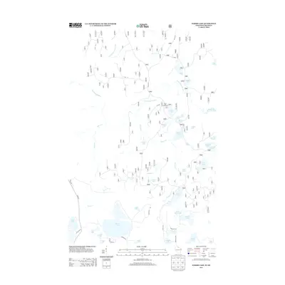
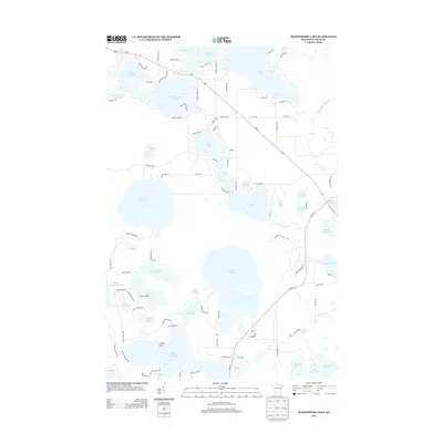
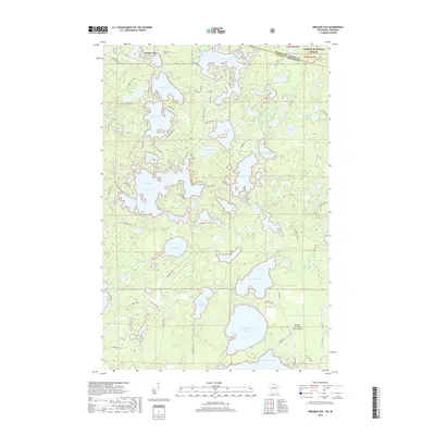
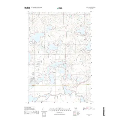
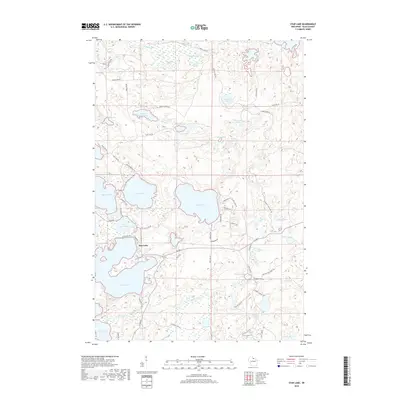
Historical Maps of Minocqua Through Time
121 maps found

1938 Phelps
Vilas County, WI

1939 Trout Lake
Vilas County, WI

1939 Winchester
Vilas County, WI

1946 Star Lake
Vilas County, WI

1946 Trout Lake
Vilas County, WI

1946 Winchester
Vilas County, WI

1949 Trout Lake
Vilas County, WI

1950 Phelps
Vilas County, WI

1950 Star Lake
Vilas County, WI

1955 Starlake
Vilas County, WI

1955 Winchester
Vilas County, WI

1956 Phelps
Vilas County, WI

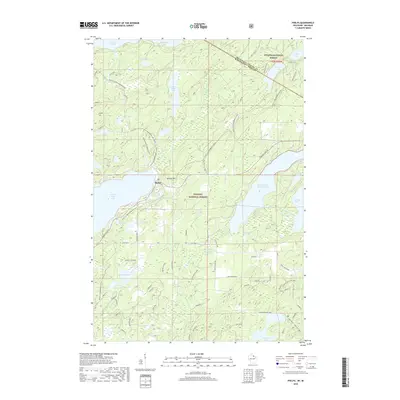
1970 Anvil Lake
Vilas County, WI

1970 Eagle River East
Vilas County, WI

1970 Eagle River West
Vilas County, WI

1970 St. Germain
Vilas County, WI

1971 Fence Lake
Vilas County, WI

1971 Lac Du Flambeau
Vilas County, WI

1981 Black Oak Lake
Vilas County, WI

1981 Manitowish Lake
Vilas County, WI

1981 Papoose Lake
Vilas County, WI

1981 Phelps
Vilas County, WI

1981 Pioneer Lake
Vilas County, WI

1981 Presque Isle
Vilas County, WI

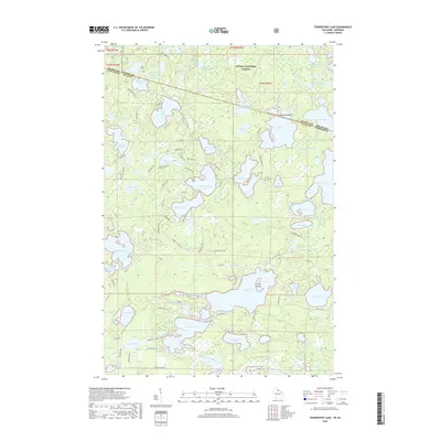
1981 Tenderfoot Lake
Vilas County, WI

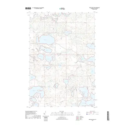
1981 White Sand Lake
Vilas County, WI

1982 Harris Lake
Vilas County, WI

1982 Land O'Lakes
Vilas County, WI

1982 Star Lake
Vilas County, WI

1982 Stormy Lake
Vilas County, WI

1999 Black Oak Lake
Vilas County, WI

1999 Land O'Lakes
Vilas County, WI

1999 Phelps
Vilas County, WI

1999 Presque Isle
Vilas County, WI

1999 Tenderfoot Lake
Vilas County, WI
2005 Lac Du Flambeau
Vilas County, WI
2010 Eagle River West
Vilas County, WI
2010 Fence Lake
Vilas County, WI
2010 Manitowish Lake
Vilas County, WI
2010 Papoose Lake
Vilas County, WI
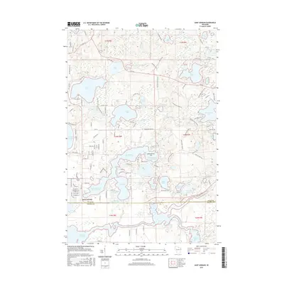
2010 Saint Germain
Vilas County, WI
2010 Star Lake
Vilas County, WI
2010 Stormy Lake
Vilas County, WI
2010 White Sand Lake
Vilas County, WI
2011 Anvil Lake
Vilas County, WI
2011 Black Oak Lake
Vilas County, WI
2011 Eagle River East
Vilas County, WI
2011 Harris Lake
Vilas County, WI
2011 Land O' Lakes
Vilas County, WI
2011 Phelps
Vilas County, WI
2011 Pioneer Lake
Vilas County, WI
2011 Presque Isle
Vilas County, WI
2011 Tenderfoot Lake
Vilas County, WI
2013 Anvil Lake
Vilas County, WI
2013 Black Oak Lake
Vilas County, WI
2013 Eagle River East
Vilas County, WI
2013 Eagle River West
Vilas County, WI
2013 Fence Lake
Vilas County, WI
2013 Harris Lake
Vilas County, WI

2013 Land O' Lakes
Vilas County, WI
2013 Manitowish Lake
Vilas County, WI
2013 Papoose Lake
Vilas County, WI
2013 Phelps
Vilas County, WI
2013 Pioneer Lake
Vilas County, WI
2013 Presque Isle
Vilas County, WI
2013 Saint Germain
Vilas County, WI
2013 Star Lake
Vilas County, WI
2013 Stormy Lake
Vilas County, WI
2013 Tenderfoot Lake
Vilas County, WI
2013 White Sand Lake
Vilas County, WI
2015 Anvil Lake
Vilas County, WI
2015 Black Oak Lake
Vilas County, WI
2015 Eagle River East
Vilas County, WI
2015 Eagle River West
Vilas County, WI
2015 Fence Lake
Vilas County, WI
2015 Harris Lake
Vilas County, WI
2015 Land O' Lakes
Vilas County, WI
2015 Manitowish Lake
Vilas County, WI
2015 Papoose Lake
Vilas County, WI
2015 Phelps
Vilas County, WI
2015 Pioneer Lake
Vilas County, WI
2015 Presque Isle
Vilas County, WI
2015 Saint Germain
Vilas County, WI
2015 Star Lake
Vilas County, WI
2015 Stormy Lake
Vilas County, WI
2015 Tenderfoot Lake
Vilas County, WI
2015 White Sand Lake
Vilas County, WI
2018 Anvil Lake
Vilas County, WI
2018 Black Oak Lake
Vilas County, WI
2018 Eagle River East
Vilas County, WI
2018 Eagle River West
Vilas County, WI
2018 Fence Lake
Vilas County, WI
2018 Harris Lake
Vilas County, WI
2018 Land O' Lakes
Vilas County, WI
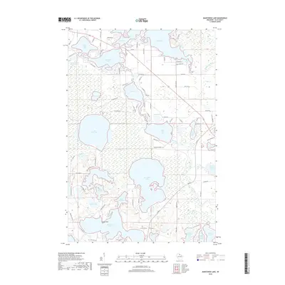
2018 Manitowish Lake
Vilas County, WI
2018 Papoose Lake
Vilas County, WI
2018 Phelps
Vilas County, WI
2018 Pioneer Lake
Vilas County, WI
2018 Presque Isle
Vilas County, WI
2018 Saint Germain
Vilas County, WI
2018 Star Lake
Vilas County, WI
2018 Stormy Lake
Vilas County, WI
2018 Tenderfoot Lake
Vilas County, WI
2018 White Sand Lake
Vilas County, WI

2022 Anvil Lake
Vilas County, WI

2022 Black Oak Lake
Vilas County, WI

2022 Eagle River East
Vilas County, WI

2022 Eagle River West
Vilas County, WI

2022 Fence Lake
Vilas County, WI

2022 Harris Lake
Vilas County, WI

2022 Land O' Lakes
Vilas County, WI

2022 Manitowish Lake
Vilas County, WI

2022 Papoose Lake
Vilas County, WI

2022 Phelps
Vilas County, WI

2022 Pioneer Lake
Vilas County, WI

2022 Presque Isle
Vilas County, WI

2022 Saint Germain
Vilas County, WI

2022 Stormy Lake
Vilas County, WI

2022 Tenderfoot Lake
Vilas County, WI

2022 White Sand Lake
Vilas County, WI

2023 Star Lake
Vilas County, WI