Old Maps of Oneida County, Wisconsin
Explore 286 old maps of Oneida County, spanning from 1928 to today. These high-resolution historic maps reveal how streets, neighborhoods, landmarks, and natural features evolved over time — perfect for genealogy, metal detecting, research, and local history exploration.
What you can do with these maps:
- See how Oneida County changed over time: Compare historical maps to modern-day views to trace roads, homesites, rail lines & more.
- View detailed metadata: Each map includes creators, publishers, year, scale, and archive source.
- Overlay maps with satellite & LiDAR: Visualize the past alongside modern tools to explore terrain & human change.
- Trusted historical sources: Maps sourced from the USGS, Library of Congress, and other archives.
- Access maps your way: View online, download high-res files, or order prints for personal or research use.
Start exploring old maps of Oneida County to uncover forgotten places, hidden landmarks, and the deep history beneath your feet.
Oneida County, WI maps
(286)- 1928 Map of Three Lakes
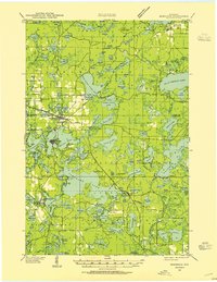
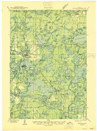
 1928 Three Lakes1928 Print · USGSThe Northwoods of Vilas and Oneida Counties come into focus in the late 1920s as early motor roads begin to connect the region's vast chain of lakes. Genealogists and local historians can locate early landmarks like Mayo Sch, the settlement of Hutchinson, and the original footprints of Eagle River and Three Lakes.
 - 1930 Map of Robbins
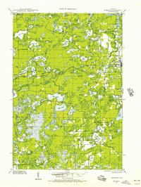
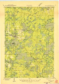
 1930 Robbins1930 Print · USGSThe Vilas and Oneida County lake country comes into focus in the early 1930s as tourism and industry overlap. Locate vanished rural schoolhouses like Evergreen Sch. and Sebastian Sch. or trace the early path of the Chicago and Northwestern RR.2 unique versions available
 - 1938 Map of Minocqua, 1955 Print
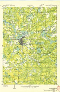
 1938 Minocqua1955 Print · USGSOneida and Vilas Counties are shown as a thriving Northwoods destination in the late thirties, when rail lines still delivered visitors to the lakefronts. Trace the footprints of local life at Hall Sch, Evergreen Cem, and the Muskellunge Fire Tower.2 unique versions available
 - 1938 Map of Three Lakes, 1956 Print
 1938 Three Lakes1956 Print · USGSThe lake country of Oneida and Vilas counties is shown here in the late 1930s, capturing the early layout of regional resorts and logging outposts. Genealogists can trace family footprints near Three Lakes, Sanborn Sch, and the Chicago and Northwestern rail line.2 unique versions available
 - 1938 Map of Robbins, 1957 Print
 1938 Robbins1957 Print · USGSNorthern Wisconsin’s lake country was a mosaic of rural school districts and new hydroelectric power in the late 1930s. Genealogists can locate family-named landmarks like Kuehn Sch and Bohemian Sch or trace the early Rhinelander Trail.2 unique versions available
 - 1938 Map of Lac Du Flambeau, 1959 Print
 1938 Lac Du Flambeau1959 Print · USGSThe Wisconsin lake district appears in detail during the late 1930s, showing the early infrastructure of the northern woods. Researchers can trace the Chicago and Northwestern rail line and locate community landmarks like Marlands Sch and the Flambeau Fire Tower.2 unique versions available
 - 1939 Map of Lac Du Flambeau
 1939 Lac Du Flambeau1939 Print · USGSWisconsin's lake country is captured here in the late thirties, documenting a landscape defined by the intersection of tribal lands and national forests. Genealogists and historians can trace the early rail stops and rural schoolhouses like Marlands Sch, Hasener, and the Lac du Flambeau Sta.
 - 1939 Map of Mc Cord
 1939 Mc Cord1939 Print · USGSOneida and Lincoln counties come into focus during the late 1930s as a land of timber, railroads, and nascent reservoirs. Genealogists and local historians can trace the foundations of settlements like Clifford and Tripoli or locate vanished rural schoolhouses such as Somo Lake Sch and Kelly Sch.3 unique versions available
 - 1939 Map of Cassian, 1946 Print
 1939 Cassian1946 Print · USGSOneida County's Northwoods come into focus in the late thirties, showing a landscape defined by glacial lakes and timber-country rail lines. Genealogists can trace rural life through scattered schoolhouses like Fernwood Sch and Stewart Sch or rail stops at Heafford Junction and Goodnow.4 unique versions available
 - 1940 Map of Parrish
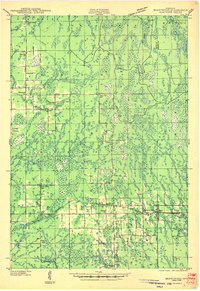
 1940 Parrish1940 Print · USGSUpper Wisconsin during the early 1940s is captured here at the edges of Three counties. Researchers can trace the Chicago and Northwestern rail line and locate the Enterprise settlement near Shingle Mill Lake before the full survey was completed.
 - 1940 Map of Monico, 1955 Print
 1940 Monico1955 Print · USGSThe Northwoods of Oneida and Forest counties are captured here just before the mid-century, defined by the crossing of major rail lines and a maze of glacial lakes. Genealogists and researchers can trace the early footprints of Monico, Jennings, and Nashville, or locate local landmarks like Forest Home Cem.
 - 1940 Map of Rhinelander, 1961 Print
 1940 Rhinelander1961 Print · USGSRhinelander and the surrounding lake country are captured here in the early 1940s, just as the rail-and-timber era had matured. Genealogists and local historians can trace rural school districts like Burkhart Sch and Clovernook Sch or locate the Our Saviour Ch among the region's many lakes.
 - 1941 Map of Pike Lake, 1952 Print
 1941 Pike Lake1952 Print · USGSPrice County timberland and lake country are captured here at the end of the 1930s as the river-and-rail economy transitioned toward forest management. Genealogists and historians can locate the Riley Creek CCC Camp, the Shady Knoll Sch, and landmarks like the South Fork Fire Tower.3 unique versions available
 - 1941 Map of Brantwood, 1971 Print
 1941 Brantwood1971 Print · USGSNorth-central Wisconsin is captured here in the early 1940s as a landscape of timber and rail-line settlements. You can trace the rural school system through Lone Corner Sch and Dover 3-E Sch, or locate family sites at Emery Cem and Brantwood.
 - 1942 Map of Pike Lake
 1942 Pike Lake1942 Print · USGSPrice County and the surrounding lake country are documented here in the early 1940s, showing a landscape shaped by timber and early recreation. Researchers can trace the Riley Creek CCC Camp, the Shady Knoll Sch, and landmarks like the South Fork Fire Tower.
 - 1942 Map of Cassian
 1942 Cassian1942 Print · USGSOneida County's lake country is seen here in the late 1930s as a hub of rail activity and forestry. Genealogists and researchers can trace rural school sites like Crescent Flats Sch and follow the rail junctions at Heafford Junction and Cassian (Deer Trail Sta).
 - 1942 Map of Elcho
 1942 Elcho1942 Print · USGSUpper Wisconsin’s lake country appears here in the early 1940s, showing a landscape of scattered rural schools and forest townships. Genealogists and researchers can trace local roots at the Enterprise Cem, St Johns Ch, or find family landmarks near Pelican Lake.
 - 1943 Map of Brantwood
 1943 Brantwood1943 Print · USGSPrice and Oneida counties are shown here just after the start of the war, when the Minneapolis St Paul and Sault Ste Marie rail line anchored a series of rural timber and farming hamlets. Genealogists can locate numerous local landmarks like St Marys Cem, the Knox Mills Sch, and the vanished site of Jordan.2 unique versions available
 - 1945 Map of Three Lakes, 1946 Print
 1945 Three Lakes1946 Print · USGSThe Wisconsin Northwoods are seen here during the mid-1940s, a landscape defined by a sprawling lakeland and the Chicago and Northwestern railroad. Genealogists and historians can trace the early layout of Three Lakes and find rural landmarks like Evergreen Sch and Jones Dam.3 unique versions available
 - 1945 Map of Robbins, 1946 Print
 1945 Robbins1946 Print · USGSWisconsin's Northwoods come alive in this mid-century survey of the lake country around the Vilas and Oneida county line. Genealogists can trace family footprints through numerous rural schoolhouses like Lake Kathan Sch and forgotten sites like Wakefield and Robbins.
 - 1946 Map of Minocqua
 1946 Minocqua1946 Print · USGSThe Wisconsin Northwoods thrive in the mid-1940s, showing a landscape of glacial lakes and bustling rail-connected resort towns. Genealogists and local historians can trace rural institutions like Faulkner Sch, the State Fish Hatchery, and the Evergreen Ch.
 - 1946 Map of Lac Du Flambeau
 1946 Lac Du Flambeau1946 Print · USGSOneida and Vilas counties are seen here in the mid-1940s, a time when the lake country was defined by timber management and rail access. Genealogists can locate the Marlands Sch and Lac du Flambeau Sta along the Chicago and Northwestern line.
 - 1947 Map of Mc Cord
 1947 Mc Cord1947 Print · USGSOneida and Lincoln counties come into focus during the late 1930s and 1940s as a landscape of timber, rail, and water. Genealogists and historians can locate rural schoolhouses like Lund Sch, the CCC Camp at Mc Cord, and the Prairie Rapids Ch.
 - 1949 Map of Rhinelander
 1949 Rhinelander1949 Print · USGSNorthern Wisconsin lake country comes alive in this late 1940s survey centered on the bustling hub of Rhinelander. Genealogists and historians can trace the paths of the Chicago and North Western Railway or locate rural landmarks like Trotier Sch and Emden Sch.
 - 1949 Map of Minocqua
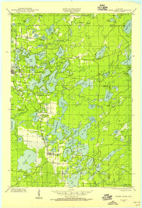
 1949 Minocqua1949 Print · USGSThe heart of the Wisconsin Northwoods is captured here at mid-century, defined by a dense tapestry of lakes and early railroad corridors. Genealogists and historians can trace family-named schools and early lakeside settlements like Arbor Vitae, Sayner, and Hazelhurst.
Showing maps 1-25 of 286
Top cities of Oneida County
- Rhinelander historical maps
- Minocqua historical maps
- Newbold historical maps
- Three Lakes historical maps
- Sugar Camp historical maps
- Hazelhurst historical maps
See more
Frequently asked questions
- What are the different types of historical maps available for Oneida County?
- What is the oldest map of Oneida County?
- Where can I purchase historical maps of Oneida County for my home or office?
- Where can I download high-res historical maps of Oneida County?
- Are there historical topographic maps available for Oneida County?
- Is there historical aerial imagery available for Oneida County?
- Where are historical maps of Oneida County sourced from?