2022 Map of Lagrange
USGS Topo · Published 2022About this map
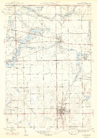
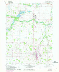
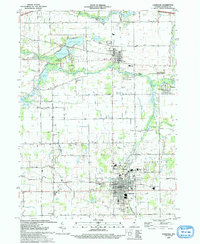
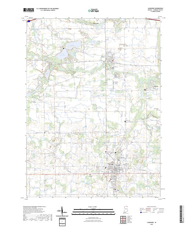
The LaGrange County Courthouse stands as the civic heart of Lagrange, where a grid of streets including W North St and W Central Ave organizes the county seat. This northeastern Indiana landscape is defined by its complex hydrography, featuring the winding Pigeon River and an extensive network of drainage infrastructure like McManus Ditch, Rowe Ditch, and Hostetler Ditch. These waterways reflect the agricultural foundations of the region, where rural life is anchored by established settlements like Howe and Ontario. Genealogists will find several burial grounds across the township, from the centrally located Greenwood Cem to the County Farm Cem and Riverside Cem. The presence of Star Mill on the Fawn River and the Reid-Eash Airport indicates the diverse economic history of the area, spanning traditional milling to modern aviation.
Find a feature on this map
78 named features on this map. Tap any name to fly to it.
Don’t see what you’re looking for? This feature index may not catch every label — zoom into the map to look around manually.
Map Details
Editions of this 2022 Lagrange Map
This is the sole edition of this map. No revisions or reprints were ever made.
Historical Maps of River Oaks Through Time
4 maps found