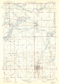
1947 Map of Lagrange
USGS Topo · Published 1947About this map
Lagrange serves as the central hub of this 1945 survey, showcasing a developed street grid and a prominent Pennsylvania railroad line running north through the heart of the township. This period of Northern Indiana history is marked by the presence of the Howe Military Sch in the settlement of Howe, alongside several rural educational and religious sites including Saylor Sch, Green Sch, and Bethel Ch.
Find a feature on this map
32 named features on this map. Tap any name to fly to it.
Don’t see what you’re looking for? This feature index may not catch every label — zoom into the map to look around manually.
Map Details
Editions of this 1947 Lagrange Map
2 editions found
Other maps of this area

1914 · Three Rivers
USGS Topo · 1:62,500

1916 · Three Rivers
USGS Topo · 1:62,500

1943 · Three Rivers
USGS Topo · 1:62,500

1947 · Mongo
USGS Topo · 1:24,000

1947 · Lagrange
USGS Topo · 1:24,000

1947 · Wolcottville
USGS Topo · 1:24,000

1947 · Oliver Lake
USGS Topo · 1:24,000

1953 · Fort Wayne
USGS Topo · 1:250,000

1956 · Fort Wayne
USGS Topo · 1:250,000

1959 · Wolcottville
USGS Topo · 1:24,000