
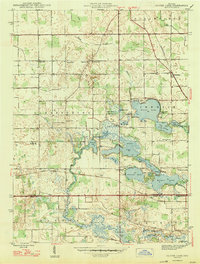
1947 Map of Oliver Lake
USGS Topo · Published 1947About this map
The waters of Oliver Lake and its interconnected chain of basins dominate the landscape of LaGrange and Noble counties in the mid-1940s. This survey illustrates a complex glacial hydrology where the North Branch Elkhart River and Middle Branch Elkhart River feed into numerous named lakes including Witmer Lake, Dallas Lake, and Messick Lake. The area's social fabric is evidenced by small rural settlements like Valentine and institutions such as the Rogers Orphanage and Limberlost Camp.
Find a feature on this map
57 named features on this map. Tap any name to fly to it.
Don’t see what you’re looking for? This feature index may not catch every label — zoom into the map to look around manually.
Map Details
Editions of this 1947 Oliver Lake Map
2 editions found
Other maps of this area

1947 · Mongo
USGS Topo · 1:24,000

1947 · Lagrange
USGS Topo · 1:24,000

1947 · Wolcottville
USGS Topo · 1:24,000

1953 · Fort Wayne
USGS Topo · 1:250,000

1955 · Kendallville
USGS Topo · 1:24,000

1956 · Fort Wayne
USGS Topo · 1:250,000

1956 · Ligonier
USGS Topo · 1:24,000

1956 · Albion
USGS Topo · 1:24,000

1959 · Wolcottville
USGS Topo · 1:24,000

1959 · Topeka
USGS Topo · 1:24,000