
1959 Map of Topeka
USGS Topo · Published 1961About this map
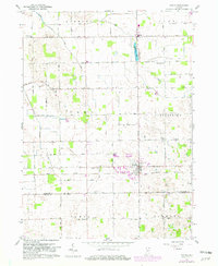
Topeka serves as the central hub of this late 1950s agricultural landscape, situated at the intersection of rural roads and the Wabash line. The map reveals a densely settled farming community across Eden and Clearspring townships, characterized by a high concentration of local institutions. Numerous country schools like Wortinger Sch and Poynter Sch are distributed across the grid, alongside several spiritual and commemorative sites including Town Line Ch and Hawpatch Cem.
Find a feature on this map
27 named features on this map. Tap any name to fly to it.
Don’t see what you’re looking for? This feature index may not catch every label — zoom into the map to look around manually.
Map Details
Editions of this 1959 Topeka Map
2 editions found
Other maps of this area

1947 · Lagrange
USGS Topo · 1:24,000

1947 · Oliver Lake
USGS Topo · 1:24,000

1951 · Wawasee
USGS Topo · 1:24,000

1953 · Fort Wayne
USGS Topo · 1:250,000

1956 · Fort Wayne
USGS Topo · 1:250,000

1956 · Ligonier
USGS Topo · 1:24,000

1956 · Albion
USGS Topo · 1:24,000
1959 · Oliver Lake
USGS Topo · 1:24,000

1959 · Millersburg
USGS Topo · 1:24,000
1960 · Lagrange
USGS Topo · 1:24,000