Old Maps of Noble County, Indiana
Explore 111 old maps of Noble County, spanning from 1942 to today. These high-resolution historic maps reveal how streets, neighborhoods, landmarks, and natural features evolved over time — perfect for genealogy, metal detecting, research, and local history exploration.
What you can do with these maps:
- See how Noble County changed over time: Compare historical maps to modern-day views to trace roads, homesites, rail lines & more.
- View detailed metadata: Each map includes creators, publishers, year, scale, and archive source.
- Overlay maps with satellite & LiDAR: Visualize the past alongside modern tools to explore terrain & human change.
- Trusted historical sources: Maps sourced from the USGS, Library of Congress, and other archives.
- Access maps your way: View online, download high-res files, or order prints for personal or research use.
Start exploring old maps of Noble County to uncover forgotten places, hidden landmarks, and the deep history beneath your feet.
Noble County, IN maps
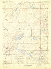
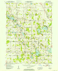
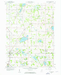
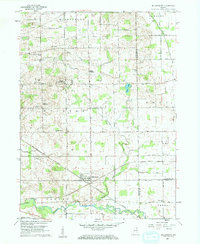
(111)- 1942 Map of Stroh
 1942 Stroh1942 Print · USGSNortheast Indiana’s lake country is captured here in the early 1940s, showing a landscape of small farming hamlets and lakeside landings. Researchers can trace family roots at Reed Cem or locate old community hubs like Salem Center and Helmer.2 unique versions available
 - 1947 Map of Wolcottville
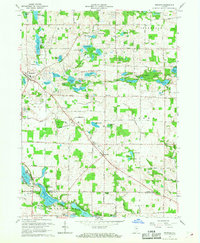
 1947 Wolcottville1947 Print · USGSThe lake-strewn border of LaGrange and Noble counties is captured here just after the war, showing the vital rail junction at Wolcottville. Genealogists and local historians can trace family plots at Bethel Cem or locate the distinctive Kneipp Springs Sanitarium.2 unique versions available
 - 1947 Map of Oliver Lake
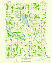
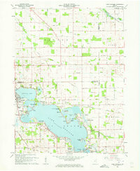
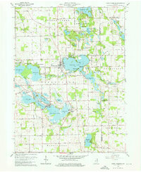
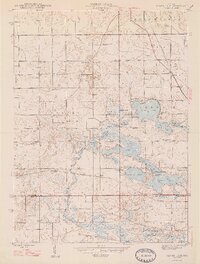 1947 Oliver Lake1947 Print · USGSLaGrange and Noble counties appear here just after the war, defined by a dense network of glacial lakes and small farming communities. Researchers can trace the legacy of local landmarks like the Rogers Orphanage, the Limberlost Camp, and family burial grounds including Osborn Cem.2 unique versions available
 - 1950 Map of North Webster, 1952 Print
 1950 North Webster1952 Print · USGSKosciusko County’s lake country was a thriving hub of summer camps and rural parishes at the start of the 1950s. Genealogists and local researchers can trace old family sites and shoreline developments near North Webster, Epworth Forest, and Morris Chapel.2 unique versions available
 - 1951 Map of Wawasee
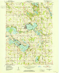
 1951 Wawasee1951 Print · USGSKosciusko and Noble counties are captured here in the early fifties, showing the vibrant lakeside communities and rural townships. Genealogists can trace family landmarks and early schools like Judy School, Weybright Cem, and the Zion Church near the town of Syracuse.2 unique versions available
 - 1951 Map of Ormas, 1952 Print
 1951 Ormas1952 Print · USGSThe Noble and Whitley County borderlands are defined by a dense cluster of glacial lakes and the winding Tippecanoe River during the early fifties. Genealogists and local historians can locate Metz Cem, West Etna Community Ch, and the old Washington Twp Sch.2 unique versions available
 - 1951 Map of Merriam, 1953 Print
 1951 Merriam1953 Print · USGSNoble and Whitley counties are shown here in the early fifties, characterized by an intricate network of small lakes and rural parishes. Genealogists can locate family landmarks like the Sanford Cem, Merriam Chapel, and the village of Wolf Lake.2 unique versions available
 - 1953 Map of Fort Wayne, 1963 Print
 1953 Fort Wayne1963 Print · USGSNortheast Indiana and its neighboring borderlands in Michigan and Ohio appear here during a peak era of rail and road expansion. Researchers can trace the massive rail networks of the Nickel Plate Road and Wabash or locate lakeside landmarks like Lake Wawasee and Clear Lake.4 unique versions available
 - 1955 Map of Corunna, 1957 Print
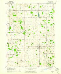
 1955 Corunna1957 Print · USGSDeKalb and Noble Counties are captured here in the mid-1950s, showing a landscape shaped by glacial lakes and the reach of the Pennsylvania railroad. Researchers can trace rural life through landmarks like Allen Chapel, the Township Sch, and the small settlement at Fairfield Center.
 - 1955 Map of Ege, 1957 Print
 1955 Ege1957 Print · USGSNoble County's glacial landscape is captured here in the mid-1950s, showing a rural network of small farming communities and rail-side settlements. Researchers can trace family history through sites like Bakerstown, Rehoboth Ch, and cemeteries including Hooper Cem and Grays Cem.
 - 1955 Map of Kendallville, 1957 Print
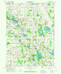
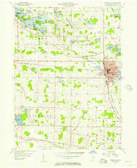 1955 Kendallville1957 Print · USGSNorthern Indiana's lake country is captured here in the mid-1950s, centered on the rail crossroads of Noble County. You can trace the grounds of the Gene Stratton Porter State Memorial or locate family sites near Lisbon and Mt Pleasant Ch.
 - 1956 Map of Fort Wayne
 1956 Fort Wayne1956 Print · USGSThe tri-state borderlands of Indiana, Michigan, and Ohio are captured here in the mid-fifties, centered on the growing industrial hub of Fort Wayne. Researchers can trace the heavy rail lines of the New York Central and Pennsylvania alongside prominent water features like Lake Wawasee and the Maumee River.2 unique versions available
 - 1956 Map of Ligonier
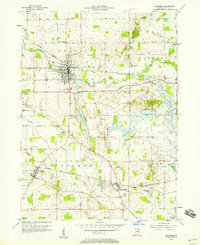 1956 Ligonier1956 Print · USGSNoble County in the mid-fifties is a landscape of thriving rail towns and glacial lakes where the forks of the Elkhart River meet. Researchers can trace the legacy of Cromwell and Ligonier, or locate family sites near Valley Cem and Perry Center Sch.
 - 1956 Map of Albion, 1958 Print
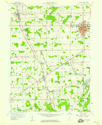
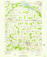 1956 Albion1958 Print · USGSNoble County in the mid-fifties is a landscape of glacial lakes and bustling rail lines connecting small rural townships. Genealogists can locate family sites at Rose Hill Cemetery and Orange Cemetery, or trace the old New York Central System through Wawaka and Brimfield.2 unique versions available
 - 1957 Map of Garrett, 1959 Print
 1957 Garrett1959 Print · USGSDeKalb and Noble County landscapes converge here in the late fifties, showcasing a robust railroad economy centered on Garrett. Genealogists and local historians can trace rural family roots through landmarks like Bethlehem Ch, Fitch, and the Swan Cem.
 - 1959 Map of Wolcottville, 1960 Print
 1959 Wolcottville1960 Print · USGSWolcottville and South Milford are shown in the late fifties at the intersection of the Pennsylvania and Wabash railroads. Genealogists and local historians can trace family-named sites like Kneipp Springs Sanitarium, Brushy Chapel Cem, and Woodruff.3 unique versions available
 - 1959 Map of Stroh, 1960 Print
 1959 Stroh1960 Print · USGSNortheast Indiana at the end of the fifties reveals a landscape defined by glacial waters where four counties meet. Genealogists and local historians can locate lakeside communities like Shady Nook and family-centered landmarks such as Weston Chapel Cem and Salem Center Sch.2 unique versions available
 - 1959 Map of Topeka, 1961 Print
 1959 Topeka1961 Print · USGSLaGrange County farmland is captured here in the late fifties, showing a landscape defined by traditional farmsteads and small-town rail commerce. Genealogists can locate family-named landmarks and rural centers like Honeyville, Salem Ch, and Maple Grove Cem.2 unique versions available
 - 1959 Map of Oliver Lake, 1961 Print
 1959 Oliver Lake1961 Print · USGSLaGrange County and the Indian Lakes region are shown in detail during the late fifties, a period of established lakeside camps and rail-line activity. Genealogists can locate family landmarks like Taylor Sch, Miller Cem, and the village of Wolcottville.
 - 1959 Map of Millersburg, 1961 Print
 1959 Millersburg1961 Print · USGSMillersburg and the surrounding Elkhart County townships are captured here in the late fifties, showing a landscape defined by small-town life and the New York Central railroad. Genealogists and local historians can locate many country churches and burial grounds, such as Clinton Brick Ch, Fair Haven Ch, and Miller Cem.4 unique versions available
 - 1961 Map of Lake Wawasee, 1963 Print
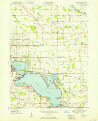
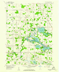
 1961 Lake Wawasee1963 Print · USGSKosciusko County lakelife in the early sixties centers on Lake Wawasee and its surrounding communities. Researchers can trace family history through sites like Hire Cemetery, Juday School, and the lakeside settlements of Vawter Park and Pickwick Park.3 unique versions available
 - 1962 Map of North Webster, 1964 Print
 1962 North Webster1964 Print · USGSKosciusko County lakeland in the early sixties reveals a landscape of summer camps and sprawling shoreline settlements. Trace family roots and local history at Indian Village, Mock Cem, and the specialized Tri-County State Fish and Game Area.4 unique versions available
 - 1965 Map of Merriam, 1966 Print
 1965 Merriam1966 Print · USGSNortheastern Indiana's lake country is captured here in the mid-sixties as conservation and recreation efforts expanded. Genealogists and local historians can trace rural family sites near Merriam Cemetery or study the early footprint of Chain O'Lakes State Park.
 - 1965 Map of Ormas, 1967 Print
 1965 Ormas1967 Print · USGSNoble and Whitley counties are shown in the mid-1960s, a period when this landscape was defined by its dense clusters of glacial lakes and quiet crossroads. Researchers can locate vanished landmarks like Township Sch or trace family history at Wolf Lake Cem and Broadway Ch.
 - 1965 Map of Ege, 1968 Print
 1965 Ege1968 Print · USGSNoble and Whitley counties are captured here in the mid-1960s, showing a rural landscape of glacial lakes and small farming hamlets. You can trace family history at Rehoboth Cem or locate old community centers like Bakertown and Green Center.3 unique versions available
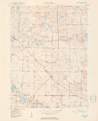
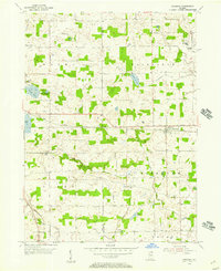
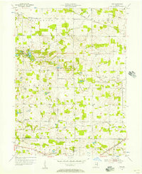
Showing maps 1-25 of 111
Top cities of Noble County
- Kendallville historical maps
- Ligonier historical maps
- Avilla historical maps
- Swan historical maps
- Albion historical maps
- Rome City historical maps
See more
Frequently asked questions
- What are the different types of historical maps available for Noble County?
- What is the oldest map of Noble County?
- Where can I purchase historical maps of Noble County for my home or office?
- Where can I download high-res historical maps of Noble County?
- Are there historical topographic maps available for Noble County?
- Is there historical aerial imagery available for Noble County?
- Where are historical maps of Noble County sourced from?