1960s Maps of Noble County, Indiana
Explore 5 historic maps of Noble County from the 1960s. These maps offer a rare glimpse into what life looked like during the 1960s — showing old roads, neighborhoods, homes, and landmarks that have changed or disappeared over time.
Whether you're researching your family's past, planning a metal detecting trip, or studying how Noble County's landscape evolved across the 1960s, these high-resolution maps are a powerful tool for exploring the history of this region.
- Focus on a specific era: All maps on this page are from the 1960s, giving you a focused view of this time period.
- See what’s changed: Compare century-old streets, trails, and buildings to today's modern landscape using overlays and satellite layers.
- Research with precision: Use these maps for genealogy, historical research, land use analysis, or educational projects.
- View, download, or print: Maps are fully viewable online in high resolution, and can be downloaded or printed for your own records.
Start exploring Noble County's history through authentic maps from the 1960s. This is your window into the past.
Noble County, IN maps
(5)- 1961 Map of Lake Wawasee, 1963 Print
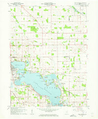 1961 Lake Wawasee1963 Print · USGSKosciusko County lakelife in the early sixties centers on Lake Wawasee and its surrounding communities. Researchers can trace family history through sites like Hire Cemetery, Juday School, and the lakeside settlements of Vawter Park and Pickwick Park.3 unique versions available
 - 1962 Map of North Webster, 1964 Print
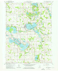 1962 North Webster1964 Print · USGSKosciusko County lakeland in the early sixties reveals a landscape of summer camps and sprawling shoreline settlements. Trace family roots and local history at Indian Village, Mock Cem, and the specialized Tri-County State Fish and Game Area.4 unique versions available
 - 1965 Map of Merriam, 1966 Print
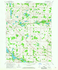 1965 Merriam1966 Print · USGSNortheastern Indiana's lake country is captured here in the mid-sixties as conservation and recreation efforts expanded. Genealogists and local historians can trace rural family sites near Merriam Cemetery or study the early footprint of Chain O'Lakes State Park.
 - 1965 Map of Ormas, 1967 Print
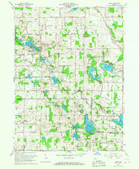 1965 Ormas1967 Print · USGSNoble and Whitley counties are shown in the mid-1960s, a period when this landscape was defined by its dense clusters of glacial lakes and quiet crossroads. Researchers can locate vanished landmarks like Township Sch or trace family history at Wolf Lake Cem and Broadway Ch.
 - 1965 Map of Ege, 1968 Print
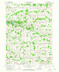 1965 Ege1968 Print · USGSNoble and Whitley counties are captured here in the mid-1960s, showing a rural landscape of glacial lakes and small farming hamlets. You can trace family history at Rehoboth Cem or locate old community centers like Bakertown and Green Center.3 unique versions available
End of results
Showing maps 1-5 of 5
Top cities of Noble County
- Kendallville historical maps
- Ligonier historical maps
- Avilla historical maps
- Swan historical maps
- Albion historical maps
- Rome City historical maps
See more
Frequently asked questions
- What are the different types of historical maps available for Noble County?
- What is the oldest map of Noble County?
- Where can I purchase historical maps of Noble County for my home or office?
- Where can I download high-res historical maps of Noble County?
- Are there historical topographic maps available for Noble County?
- Is there historical aerial imagery available for Noble County?
- Where are historical maps of Noble County sourced from?