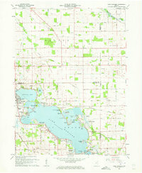
1961 Map of Lake Wawasee
USGS Topo · Published 1963About this map
Lake Wawasee dominates this part of Kosciusko County, serving as a hub for recreational and community life in the early 1960s. The shoreline is densely populated with distinct developments such as Pickwick Park, Enchanted Hills, and Vawter Park, while Syracuse Lake to the northwest supports the town of Syracuse. The landscape transitions from these developed waterfronts to a rural interior defined by family-named landmarks and essential infrastructure, including the Wawasee Airport and the Wawasee State Fish Hatchery near Turkey Creek.
Find a feature on this map
63 named features on this map. Tap any name to fly to it.
Don’t see what you’re looking for? This feature index may not catch every label — zoom into the map to look around manually.
Map Details
Editions of this 1961 Lake Wawasee Map
Other maps of this area

1950 · Leesburg
USGS Topo · 1:24,000

1950 · North Webster
USGS Topo · 1:24,000

1951 · Milford
USGS Topo · 1:24,000

1951 · Wawasee
USGS Topo · 1:24,000

1951 · Ormas
USGS Topo · 1:24,000

1953 · Fort Wayne
USGS Topo · 1:250,000

1956 · Fort Wayne
USGS Topo · 1:250,000

1956 · Ligonier
USGS Topo · 1:24,000

1959 · Topeka
USGS Topo · 1:24,000

1959 · Millersburg
USGS Topo · 1:24,000