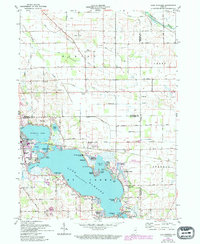
1961 Map of Lake Wawasee
USGS Topo · Published 1994About this map
Wawasee Lake and its surrounding resort communities dominate this mid-century landscape, showcasing the post-war recreation boom in northern Indiana. The shoreline is densely populated with established neighborhoods like Pickwick Park, Wawasee Village, and Enchanted Hills, while the waters are punctuated by distinctive points such as Sand Point and Cedar Point. Cultural and social life of the era is evident through the presence of the Our Lady of the Lake Seminary, the Summer Theater near Johnson Bay, and the Wawasee Golf Club.
Find a feature on this map
64 named features on this map. Tap any name to fly to it.
Don’t see what you’re looking for? This feature index may not catch every label — zoom into the map to look around manually.
Map Details
Editions of this 1961 Lake Wawasee Map
Other maps of this area

1950 · Leesburg
USGS Topo · 1:24,000

1950 · North Webster
USGS Topo · 1:24,000

1951 · Milford
USGS Topo · 1:24,000

1951 · Wawasee
USGS Topo · 1:24,000

1951 · Ormas
USGS Topo · 1:24,000

1953 · Fort Wayne
USGS Topo · 1:250,000

1956 · Fort Wayne
USGS Topo · 1:250,000

1956 · Ligonier
USGS Topo · 1:24,000

1959 · Topeka
USGS Topo · 1:24,000

1959 · Millersburg
USGS Topo · 1:24,000