2020s Maps of Noble County, Indiana
Explore 15 historic maps of Noble County from the 2020s. These maps offer a rare glimpse into what life looked like during the 2020s — showing old roads, neighborhoods, homes, and landmarks that have changed or disappeared over time.
Whether you're researching your family's past, planning a metal detecting trip, or studying how Noble County's landscape evolved across the 2020s, these high-resolution maps are a powerful tool for exploring the history of this region.
- Focus on a specific era: All maps on this page are from the 2020s, giving you a focused view of this time period.
- See what’s changed: Compare century-old streets, trails, and buildings to today's modern landscape using overlays and satellite layers.
- Research with precision: Use these maps for genealogy, historical research, land use analysis, or educational projects.
- View, download, or print: Maps are fully viewable online in high resolution, and can be downloaded or printed for your own records.
Start exploring Noble County's history through authentic maps from the 2020s. This is your window into the past.
Noble County, IN maps
(15)- 2022 Map of Oliver Lake, 2022 Print
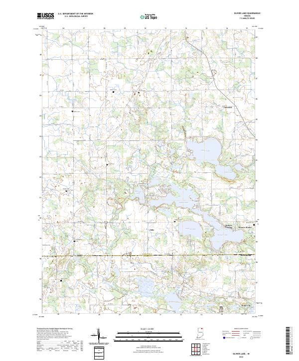 2022 Oliver Lake2022 Print · USGSLaGrange County at the start of the 2020s remains a landscape of glacial lakes and quiet crossroads settlements. Genealogists and local historians can trace family ties through numerous rural burial sites like Sloan Cem and Beulah Cem or explore the water-bound reaches of Webers Landing.
 - 2022 Map of Garrett, 2022 Print
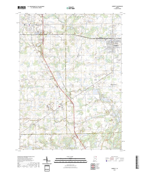 2022 Garrett2022 Print · USGSDeKalb and Noble counties come into focus in the early 2020s, showcasing a landscape defined by organized drainage and tight-knit crossroads. Researchers can trace family history at Calvary Cem, explore the residential layout of Altona, or locate the small settlement of Butler Center.
 - 2022 Map of Ligonier, 2022 Print
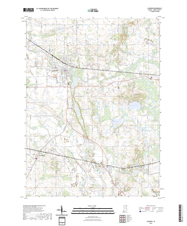 2022 Ligonier2022 Print · USGSNoble County's lake-strewn landscape is documented here in the early 2020s, centered on the historic crossroads of Ligonier. Genealogists and local historians can trace family plots at Oak Park Cem or follow the CSX Transportation line through Cromwell and Kimmell.
 - 2022 Map of Ege, 2022 Print
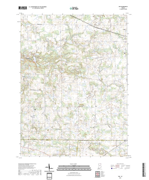 2022 Ege2022 Print · USGSNoble and Whitley counties are shown here at the turn of the millennium, characterized by rural settlements and extensive drainage networks. Researchers can trace family history through Hooper Cem and Grays Cem or locate the old crossroads at Green Center.
 - 2022 Map of Millersburg, 2022 Print
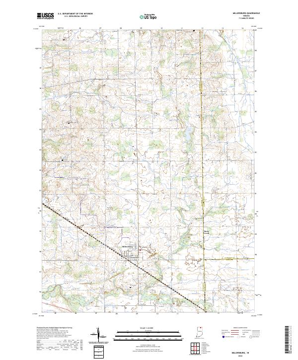 2022 Millersburg2022 Print · USGSMillersburg and the surrounding tri-county borderlands of Elkhart, LaGrange, and Noble counties are captured here in the early twenty-first century. Family history researchers can locate several small burial grounds including Nisley Cem and Brown Cem, or trace the path of the Miami Snowmobile Trl across the local drainage network.
 - 2022 Map of Lake Wawasee, 2022 Print
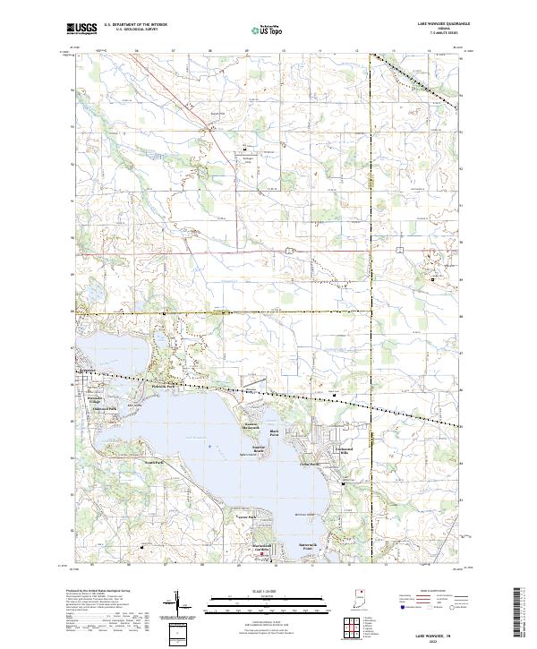 2022 Lake Wawasee2022 Print · USGSKosciusko County’s lakeside life and rural townships are captured here in the early 2020s, centered on the expansive waters of Lake Wawasee. Researchers can locate family sites at McClintic Cem or trace the development of historic neighborhoods like Vawter Park and Syracuse.
 - 2022 Map of Topeka, 2022 Print
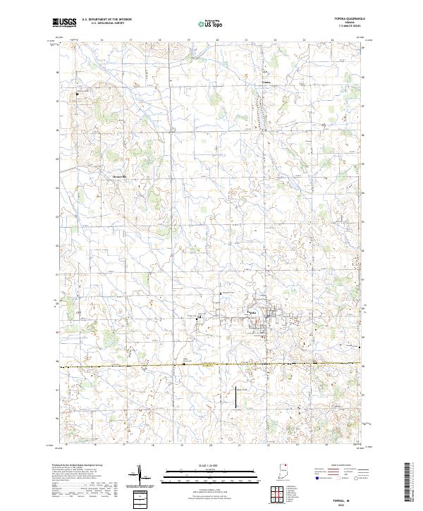 2022 Topeka2022 Print · USGSTopeka and its surrounding townships are documented in this recent survey of the LaGrange County agricultural landscape. Researchers can locate numerous family and community landmarks, from Eden Cem and Honeyville to the quiet reaches of the Little Elkhart River.
 - 2022 Map of North Webster, 2022 Print
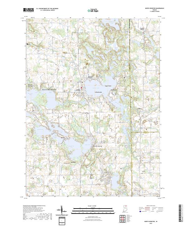 2022 North Webster2022 Print · USGSKosciusko County lake country is shown here in modern detail, where the headwaters of the Tippecanoe River weave through glacial basins. Local researchers can trace family landmarks and shoreline developments in North Webster, Indian Village, and around the banks of Webster Lake.
 - 2022 Map of Corunna, 2022 Print
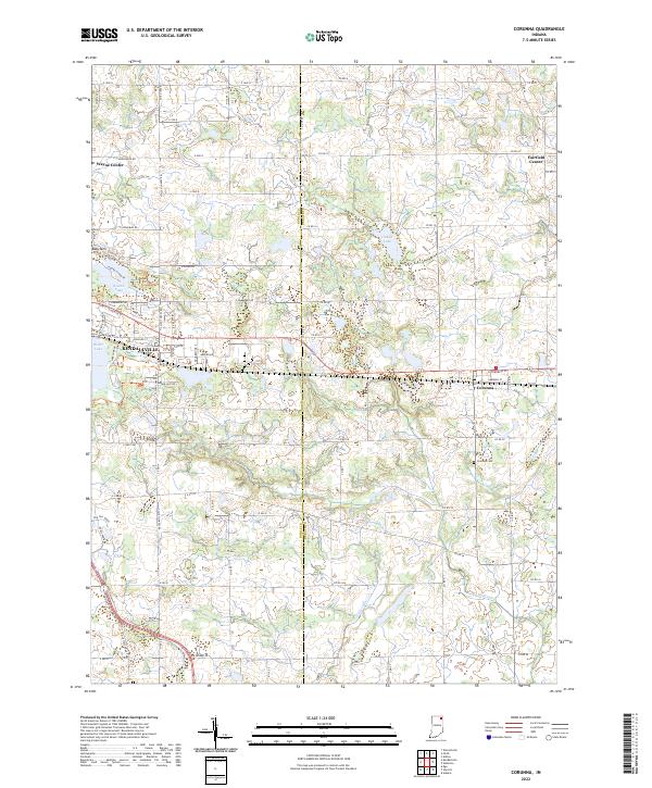 2022 Corunna2022 Print · USGSCorunna and Kendallville appear at the dawn of the 2020s in this detailed look at the Noble-DeKalb county line. Researchers can trace local lineage through the Corunna Cemetery and Fairfield Center Church, or locate the historic Wayne Center School.
 - 2022 Map of Albion, 2022 Print
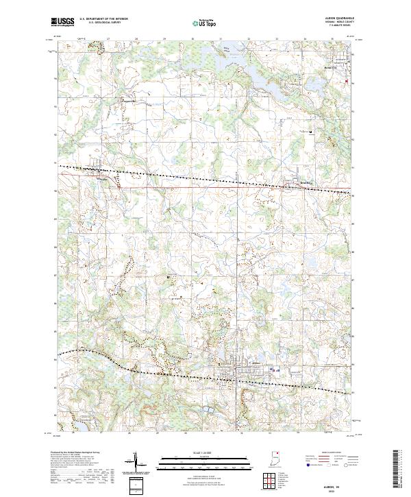 2022 Albion2022 Print · USGSNoble County's agricultural and lakeside communities are meticulously documented in this survey of the northern Indiana landscape. Researchers can trace family history through sites like Rose Hill Cem or study the rail corridors connecting Albion, Wawaka, and Brimfield.
 - 2022 Map of Wolcottville, 2022 Print
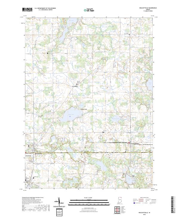 2022 Wolcottville2022 Print · USGSNortheastern Indiana's lake country is mapped here in the early 2020s, centered on the county line. Trace family sites at Woodland Cem, Kneipp Springs, and the lakeside settlements of Wolcottville and South Milford.
 - 2022 Map of Merriam, 2022 Print
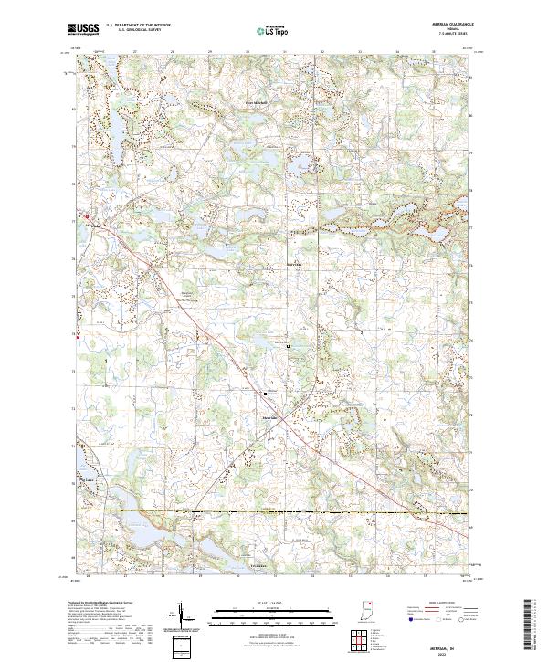 2022 Merriam2022 Print · USGSNoble and Whitley Counties are shown here during the early twenty-first century, revealing a landscape defined by glacial lakes and historic rural crossroads. Researchers can locate family burial sites at Stanford Cem and trace the development of small communities like Merriam and Wolflake.
 - 2022 Map of Ormas, 2022 Print
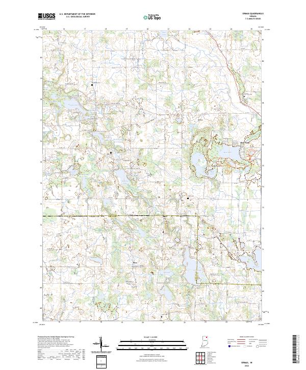 2022 Ormas2022 Print · USGSNoble and Whitley counties are shown here in the 2020s, featuring a landscape defined by the Tippecanoe River and a high density of glacial lakes. Local historians can locate the small settlements of Ormas and Etna alongside several family-named burial grounds like Metz Cem and Scott Cem.
 - 2022 Map of Kendallville, 2022 Print
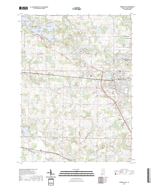 2022 Kendallville2022 Print · USGSNorthern Indiana lake country and the hub of Kendallville are documented here in the early twenty-first century. Genealogists can locate legacy sites like Lake View Cem and Perseverance Cem, or trace the Ft. Wayne to Kendallville Rail Trl.
 - 2022 Map of Stroh, 2022 Print
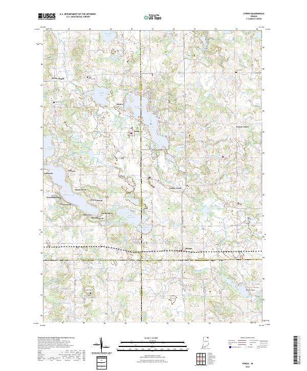 2022 Stroh2022 Print · USGSGlacial lakes and rural crossroads define this northern Indiana landscape at the borders of four counties. Genealogists and local historians can trace family roots at Bethel Cem or Wright Cem and explore lakefront developments like Gravel Beach and Shady Nook.
End of results
Showing maps 1-15 of 15
Top cities of Noble County
- Kendallville historical maps
- Ligonier historical maps
- Avilla historical maps
- Swan historical maps
- Albion historical maps
- Rome City historical maps
See more
Frequently asked questions
- What are the different types of historical maps available for Noble County?
- What is the oldest map of Noble County?
- Where can I purchase historical maps of Noble County for my home or office?
- Where can I download high-res historical maps of Noble County?
- Are there historical topographic maps available for Noble County?
- Is there historical aerial imagery available for Noble County?
- Where are historical maps of Noble County sourced from?