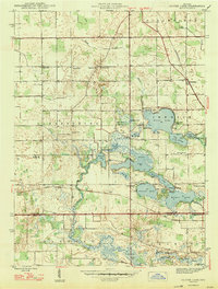
1947 Map of Oliver Lake
USGS Topo · Published 1947About this map
Glacial lake chains dominate this portion of LaGrange County, where the North Branch Elkhart River connects a string of water bodies including Oliver Lake, Witmer Lake, and Dallas Lake. The 1940s landscape shows a mix of recreational and institutional development, evidenced by the Limberlost Camp on the shores of Oliver Lake and the Rogers Orphanage located further west in Clearspring township.
Find a feature on this map
54 named features on this map. Tap any name to fly to it.
Don’t see what you’re looking for? This feature index may not catch every label — zoom into the map to look around manually.
Map Details
Editions of this 1947 Oliver Lake Map
2 editions found
Other maps of this area

1947 · Mongo
USGS Topo · 1:24,000

1947 · Lagrange
USGS Topo · 1:24,000

1947 · Wolcottville
USGS Topo · 1:24,000

1947 · Oliver Lake
USGS Topo · 1:24,000

1953 · Fort Wayne
USGS Topo · 1:250,000

1955 · Kendallville
USGS Topo · 1:24,000

1956 · Fort Wayne
USGS Topo · 1:250,000

1956 · Ligonier
USGS Topo · 1:24,000

1956 · Albion
USGS Topo · 1:24,000

1959 · Wolcottville
USGS Topo · 1:24,000