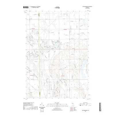
2019 Map of Lake Arrowhead
USGS Topo · Published 2019About this map
Lake Arrowhead and its neighboring waters define this portion of Northern Michigan, where a high density of small lakes and ponds are scattered across the landscape. The Manistee River flows through the western section of the map, carving a path near Lake Washigonen. This area is characterized by a complex network of recreational and access trails, many bearing descriptive or evocative names like Shoppegon Pass, Geronimos Trl, and White Clouds Trl, reflecting the region's development for outdoor leisure and summer residency. Terrain features such as Mescara Mound rise between the water bodies, while the eastern edge is punctuated by Lake Tecon and King Pond. This survey captures the modern road and trail infrastructure that connects these isolated water bodies, illustrating the contemporary layout of these glacial-formed highlands near the boundary of Antrim and Otsego counties.
Find a feature on this map
124 named features on this map. Tap any name to fly to it.
Don’t see what you’re looking for? This feature index may not catch every label — zoom into the map to look around manually.
Map Details
Editions of this 2019 Lake Arrowhead Map
This is the sole edition of this map. No revisions or reprints were ever made.
Other maps of this area

1949 · Otsego Lake
USGS Topo · 1:62,500

1951 · Big Bradford Lake
USGS Topo · 1:24,000

1951 · Otsego Lake
USGS Topo · 1:24,000

1954 · Gaylord
USGS Topo · 1:62,500

1954 · Traverse City
USGS Topo · 1:250,000

1955 · Cheboygan
USGS Topo · 1:250,000

1956 · Alba
USGS Topo · 1:62,500

1958 · Cheboygan
USGS Topo · 1:250,000

1958 · Traverse City
USGS Topo · 1:250,000

1961 · Boyne Falls
USGS Topo · 1:62,500