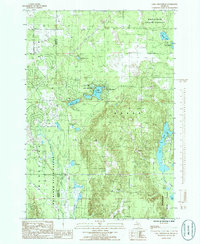
1985 Map of Lake Arrowhead
USGS Topo · Published 1986About this map
The Mackinaw State Forest dominates this mid-1980s landscape, illustrating a region shaped by timber history and glacial hydrology along the border of Antrim and Otsego counties. Numerous small lakes, including the central Lake Arrowhead and the curiously named Washwomen Lake, are scattered throughout the forested terrain. These water bodies, alongside Thomas Lake and Lake Wequas, suggest a landscape prized for recreation and seasonal residence during this era.
Find a feature on this map
27 named features on this map. Tap any name to fly to it.
Don’t see what you’re looking for? This feature index may not catch every label — zoom into the map to look around manually.
Map Details
Editions of this 1985 Lake Arrowhead Map
This is the sole edition of this map. No revisions or reprints were ever made.
Other maps of this area

1949 · Otsego Lake
USGS Topo · 1:62,500

1951 · Big Bradford Lake
USGS Topo · 1:24,000

1951 · Otsego Lake
USGS Topo · 1:24,000

1954 · Gaylord
USGS Topo · 1:62,500

1954 · Traverse City
USGS Topo · 1:250,000

1955 · Cheboygan
USGS Topo · 1:250,000

1956 · Alba
USGS Topo · 1:62,500

1958 · Cheboygan
USGS Topo · 1:250,000

1958 · Traverse City
USGS Topo · 1:250,000

1961 · Boyne Falls
USGS Topo · 1:62,500