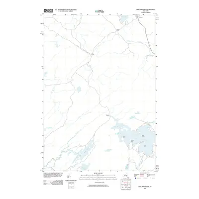
2010 Map of Lake Bonaparte
USGS Topo · Published 2010About this map
Lake Bonaparte anchors the southeastern landscape of this Saint Lawrence County survey, where complex shorelines and numerous islands define the local geography. The area's glacial heritage is evident in the dense concentration of water bodies, from larger basins like Sylvia Lake and Indian Lake to smaller features such as Snake Pond and Mud Pond. Human settlement is characterized by small rural clusters and crossroads, including Balmat in the north and Alpina near the lake’s northwestern edge. The Indian River and Bonaparte Creek weave through a network of lowlands, connecting various ponds and marshes like Marsh Pond and Benton Pond. This map details the established land-water interface at the beginning of the 21st century, showing named landforms like Bentons Point and Bullrock Point that have likely served as local landmarks for generations of residents and visitors.
Find a feature on this map
30 named features on this map. Tap any name to fly to it.
Don’t see what you’re looking for? This feature index may not catch every label — zoom into the map to look around manually.
Map Details
Editions of this 2010 Lake Bonaparte Map
This is the sole edition of this map. No revisions or reprints were ever made.
Other maps of this area

1911 · Antwerp
USGS Topo · 1:62,500

1912 · Hammond
USGS Topo · 1:62,500

1913 · Lake Bonaparte
USGS Topo · 1:62,500

1915 · Gouverneur
USGS Topo · 1:62,500

1916 · Lake Bonaparte
USGS Topo · 1:62,500

1937 · Gouverneur
USGS Topo · 1:62,500

1944 · Hammond
USGS Topo · 1:62,500

1948 · Ogdensburg
USGS Topo · 1:250,000

1949 · Hammond
USGS Topo · 1:62,500

1949 · Antwerp
USGS Topo · 1:62,500