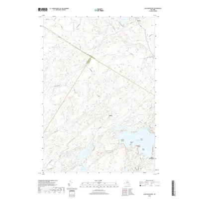
2019 Map of Lake Bonaparte
USGS Topo · Published 2019About this map
Lake Bonaparte anchors this landscape in the northern reaches of New York, where the boundaries of St Lawrence Co, Jefferson Co, and Lewis Co converge. The topography is defined by an intricate network of wetlands and water bodies, ranging from the expansive Sylvia Lake near Balmat to the secluded Indian Pond and Narrow Lake. Settlement is sparse, centered on the small communities of Balmat and Alpina, with the land primarily traversed by historic transit routes like the Russell Tpke and Fusa Blvd.
Find a feature on this map
49 named features on this map. Tap any name to fly to it.
Don’t see what you’re looking for? This feature index may not catch every label — zoom into the map to look around manually.
Map Details
Editions of this 2019 Lake Bonaparte Map
This is the sole edition of this map. No revisions or reprints were ever made.
Other maps of this area

1911 · Antwerp
USGS Topo · 1:62,500

1912 · Hammond
USGS Topo · 1:62,500

1913 · Lake Bonaparte
USGS Topo · 1:62,500

1915 · Gouverneur
USGS Topo · 1:62,500

1916 · Lake Bonaparte
USGS Topo · 1:62,500

1937 · Gouverneur
USGS Topo · 1:62,500

1944 · Hammond
USGS Topo · 1:62,500

1948 · Ogdensburg
USGS Topo · 1:250,000

1949 · Hammond
USGS Topo · 1:62,500

1949 · Antwerp
USGS Topo · 1:62,500