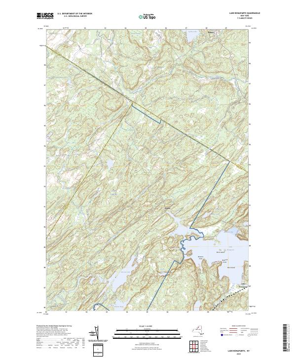
2023 Map of Lake Bonaparte
USGS Topo · Published 2023About this map
Lake Bonaparte serves as the focal point for this region where the boundaries of St. Lawrence, Jefferson, and Lewis Counties converge. The landscape is defined by an intricate network of waterways and glacial features, including Narrow Lake and the meandering course of the Indian River. Small settlements like Alpina and Balmat are situated among a complex of smaller water bodies such as Snake Pond, Mud Pond, and Burnt Pond.
Find a feature on this map
54 named features on this map. Tap any name to fly to it.
Don’t see what you’re looking for? This feature index may not catch every label — zoom into the map to look around manually.
Map Details
Editions of this 2023 Lake Bonaparte Map
This is the sole edition of this map. No revisions or reprints were ever made.
Other maps of this area

1911 · Antwerp
USGS Topo · 1:62,500

1912 · Hammond
USGS Topo · 1:62,500

1913 · Lake Bonaparte
USGS Topo · 1:62,500

1915 · Gouverneur
USGS Topo · 1:62,500

1916 · Lake Bonaparte
USGS Topo · 1:62,500

1937 · Gouverneur
USGS Topo · 1:62,500

1944 · Hammond
USGS Topo · 1:62,500

1948 · Ogdensburg
USGS Topo · 1:250,000

1949 · Hammond
USGS Topo · 1:62,500

1949 · Antwerp
USGS Topo · 1:62,500