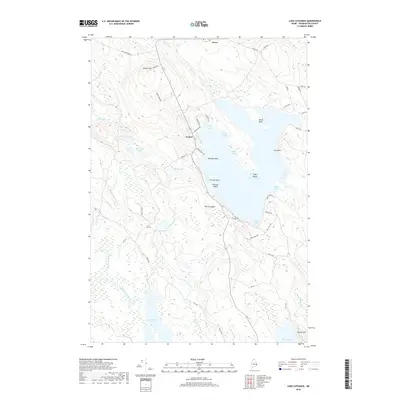
2018 Map of Lake Cathance
USGS Topo · Published 2018About this map
Lake Cathance and its intricate shoreline dominate this portion of Washington County, where the settlements of Cooper and Grove sit amidst a landscape of glacial lakes and interior wetlands. The terrain is defined by prominent elevations such as Cooper Hill and Conner Hill, which overlook a complex drainage network including Mill Stream and Rocky Lake Stream. This 2018 survey reveals a rural character maintained through a network of local routes like Old Crawford Rd and Wesley Rd, providing access to numerous water bodies including the Spectacle Lakes, Vining Lake, and Munson Lake. The map highlights the area's geography through detailed labeling of various coves and points, such as Chub Cove, Gray Cove, and Provost Point, alongside inland features like The Commons. This data is essential for understanding the spatial relationship between the region's scattered residences and its extensive aquatic resources, including the expansive Rocky Lake to the south.
Find a feature on this map
58 named features on this map. Tap any name to fly to it.
Don’t see what you’re looking for? This feature index may not catch every label — zoom into the map to look around manually.
Map Details
Editions of this 2018 Lake Cathance Map
This is the sole edition of this map. No revisions or reprints were ever made.
Other maps of this area

1929 · Calais
USGS Topo · 1:48,000

1932 · Calais
USGS Topo · 1:62,500

1941 · Wesley
USGS Topo · 1:62,500

1941 · Gardner Lake
USGS Topo · 1:62,500

1941 · Big Lake
USGS Topo · 1:62,500

1943 · Big Lake
USGS Topo · 1:62,500

1943 · Wesley
USGS Topo · 1:62,500

1943 · Gardner Lake
USGS Topo · 1:62,500

1952 · Big Lake
USGS Topo · 1:50,000

1957 · Fredericton
USGS Topo · 1:250,000