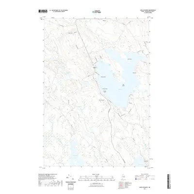
2021 Map of Lake Cathance
USGS Topo · Published 2021About this map
Lake Cathance and its intricate shoreline dominate this Washington County landscape, where the settlements of Grove and Cooper anchor a network of local roads and water bodies. The geography is defined by a glacial character, visible in the numerous lakes like Rocky Lake, Vining Lake, and Munson Lake that dot the terrain. Points of land and islands, such as Provost Point and Todd Island, segment the larger basins into distinct reaches like Chub Cove and Deep Cove.
Find a feature on this map
61 named features on this map. Tap any name to fly to it.
Don’t see what you’re looking for? This feature index may not catch every label — zoom into the map to look around manually.
Map Details
Editions of this 2021 Lake Cathance Map
This is the sole edition of this map. No revisions or reprints were ever made.
Other maps of this area

1929 · Calais
USGS Topo · 1:48,000

1932 · Calais
USGS Topo · 1:62,500

1941 · Wesley
USGS Topo · 1:62,500

1941 · Gardner Lake
USGS Topo · 1:62,500

1941 · Big Lake
USGS Topo · 1:62,500

1943 · Big Lake
USGS Topo · 1:62,500

1943 · Wesley
USGS Topo · 1:62,500

1943 · Gardner Lake
USGS Topo · 1:62,500

1952 · Big Lake
USGS Topo · 1:50,000

1957 · Fredericton
USGS Topo · 1:250,000