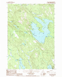
1987 Map of Lake Cathance
USGS Topo · Published 1988About this map
Lake Cathance dominates this interior Washington County landscape, framed by the towns of Cooper and Marion. In the late 1980s, the area remained a mosaic of water and timberland, characterized by the intricate shorelines of Smith Cove and Gray Cove. The terrain is defined by prominent elevations such as Cooper Hill, which is marked by both a Radio Tower and a Lookout Tower, and Conner Hill to the southeast. Settled clearings like Grove and Millpond are connected by Route 191, while the surrounding acreage is divided into historic townships including T 19 Ed BPP, T 18 Ed BPP, and No 14 Plt. The presence of several Gravel Pits reflects the local resource extraction alongside the complex hydrography of Northern Inlet and Rocky Lake Stream.
Find a feature on this map
45 named features on this map. Tap any name to fly to it.
Don’t see what you’re looking for? This feature index may not catch every label — zoom into the map to look around manually.
Map Details
Editions of this 1987 Lake Cathance Map
This is the sole edition of this map. No revisions or reprints were ever made.
Other maps of this area

1929 · Calais
USGS Topo · 1:48,000

1932 · Calais
USGS Topo · 1:62,500

1941 · Wesley
USGS Topo · 1:62,500

1941 · Gardner Lake
USGS Topo · 1:62,500

1941 · Big Lake
USGS Topo · 1:62,500

1943 · Big Lake
USGS Topo · 1:62,500

1943 · Wesley
USGS Topo · 1:62,500

1943 · Gardner Lake
USGS Topo · 1:62,500

1952 · Big Lake
USGS Topo · 1:50,000

1957 · Fredericton
USGS Topo · 1:250,000