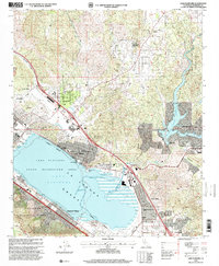
1997 Map of Lake Elsinore
USGS Topo · Published 2000About this map
Lake Elsinore dominates this landscape, reflecting a late 20th-century mix of recreation and suburban development within the historic Laguna Grant. The map illustrates the area's growth along major thoroughfares like Riverside Drive and Grand Ave, while maintaining vestiges of its industrial past such as the Good Hope Mine and its associated tailings. Local institutional history is well-documented through a dense network of schools, including Machado School and Ortega High School, serving the expanding residential districts of Lakeland Village and Sedco Hills. To the northeast, the Railroad Canyon Reservoir and Canyon Lake provide a secondary hub for water-based activity, while the western edge is defined by the protected wilderness of the Cleveland National Forest. The presence of Skylark Field and various gaging stations along the San Jacinto River points to the area's complex management of aviation and water resources.
Find a feature on this map
46 named features on this map. Tap any name to fly to it.
Don’t see what you’re looking for? This feature index may not catch every label — zoom into the map to look around manually.
Map Details
Editions of this 1997 Lake Elsinore Map
This is the sole edition of this map. No revisions or reprints were ever made.
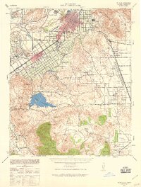
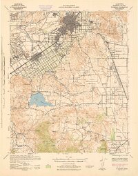
Other maps of this area

1901 · Southern California Sheet No. 1
USGS Topo · 1:250,000

1901 · Elsinore
USGS Topo · 1:125,000

1901 · Riverside
USGS Topo · 1:62,500

1904 · Southern California Sheet No. 1
USGS Topo · 1:250,000

1942 · Lake Elsinore
USGS Topo · 1:62,500

1942 · Murrieta
USGS Topo · 1:62,500
1942 · Riverside
USGS Topo · 1:62,500

1942 · Perris
USGS Topo · 1:62,500

1943 · Perris
USGS Topo · 1:62,500
1943 · Riverside
USGS Topo · 1:62,500