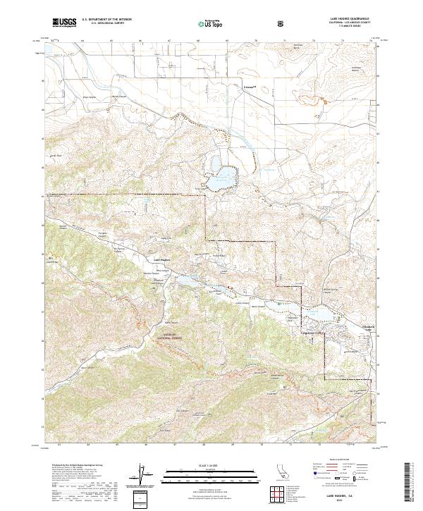
2021 Map of Lake Hughes
USGS Topo · Published 2021About this map
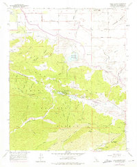
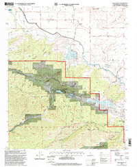
The San Andreas Fault cuts a definitive line across this landscape, separating the high desert of the Antelope Valley from the northern reaches of the Angeles National Forest. Along this tectonic rift, a string of sag ponds has created the distinct water-rich corridor of Lake Hughes and Elizabeth Lake, which served as vital stops for early travelers. The map reveals the intricate water infrastructure of the region, including the Governor Edmund G Brown East Branch California Aqueduct and the Second Los Angeles Aqueduct, which feed into the Fairmont Reservoir. Engineering history is further represented by the Elizabeth Tunnel and its South Portal, part of the massive Los Angeles Aqueduct system. High points like Fairmont Butte and Sawmill Mtn overlook a terrain characterized by canyons such as Kings Canyon and San Francisquito Canyon, while the Pacific Crest National Scenic Trail winds through the southern ridges.
Find a feature on this map
78 named features on this map. Tap any name to fly to it.
Don’t see what you’re looking for? This feature index may not catch every label — zoom into the map to look around manually.
Map Details
Editions of this 2021 Lake Hughes Map
This is the sole edition of this map. No revisions or reprints were ever made.
Historical Maps of Andrade Corner Through Time
3 maps found