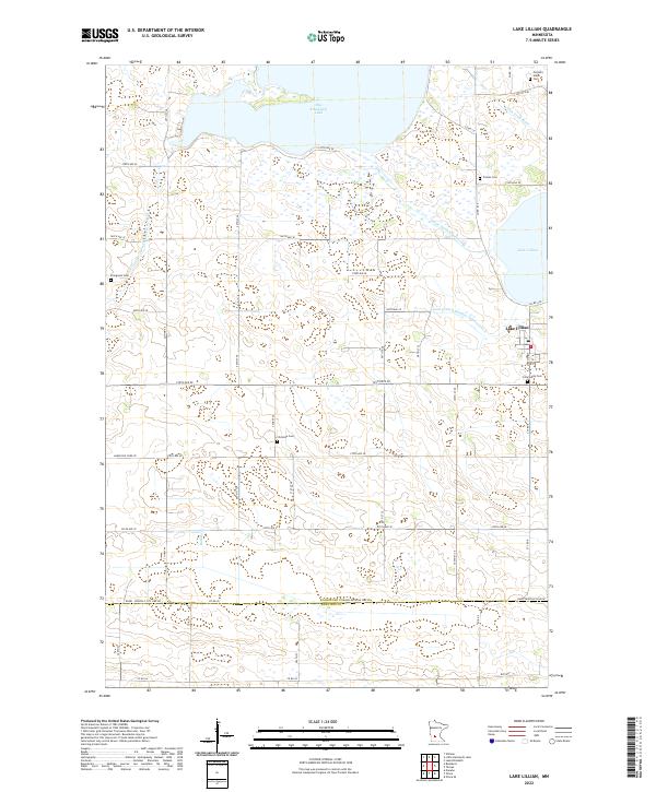
2022 Map of Lake Lillian
USGS Topo · Published 2022About this map
The settlement of Lake Lillian sits at the eastern edge of a landscape defined by an extensive drainage network in south-central Minnesota. This agricultural region relies on a system of engineered waterways such as County Ditch Number Fiftyeight, State Ditch Number One, and County Ditch Number Twenty four A to manage the prairie wetlands surrounding Big Kandiyohi Lake and the S Fork Crow River. The map reveals a high concentration of burial sites that speak to the area's early Lutheran and Scandinavian heritage, including Tromso Cem, Pioneers Union Cem, and Christina Cem. The southern portion of the survey is bounded by the Kandi Renville Line Rd, marking the division between Kandiyohi and Renville counties. This map details the intersection of rural township roads and natural features like Buffalo Cr, providing a clear look at the township and range survey lines that organized the local farming economy.
Find a feature on this map
37 named features on this map. Tap any name to fly to it.
Don’t see what you’re looking for? This feature index may not catch every label — zoom into the map to look around manually.
Map Details
Editions of this 2022 Lake Lillian Map
This is the sole edition of this map. No revisions or reprints were ever made.
Other maps of this area

1953 · New Ulm
USGS Topo · 1:250,000

1953 · Saint Cloud
USGS Topo · 1:250,000

1956 · Atwater
USGS Topo · 1:62,500

1957 · Saint Cloud
USGS Topo · 1:250,000

1957 · New Ulm
USGS Topo · 1:250,000

1957 · Olivia
USGS Topo · 1:62,500

1958 · New Ulm
USGS Topo · 1:250,000

1958 · Saint Cloud
USGS Topo · 1:250,000

1958 · Willmar
USGS Topo · 1:24,000

1965 · Danube
USGS Topo · 1:24,000