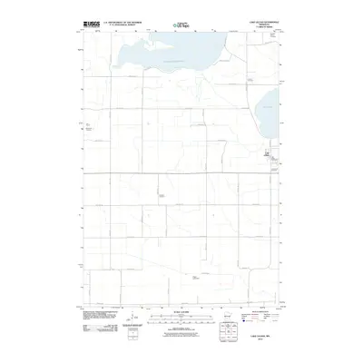
2010 Map of Lake Lillian
USGS Topo · Published 2010About this map
Big Kandiyohi Lake dominates the northern horizon of this Kandiyohi County landscape, where the agricultural grid is punctuated by numerous historical burial sites and small-town landmarks. The settlement of Lake Lillian sits on the eastern shore of its namesake water body, serving as a local hub with the Lake Lillian Post Office and a network of county roads like County Hwy 8. The map reveals a high density of rural cemeteries, including Pioneers Union Cemetery, Tromso Cemetery, and Christine Cemetery, suggesting a deeply rooted community with long-standing family ties to the land. To the south, the terrain is drained by Buffalo Creek near the Eagle Lake Dam, illustrating the managed water systems essential to this prairie region. Notable religious and civic structures like the Free Church and Community Cemetery further anchor the small clusters of settlement within the expansive township sections.
Find a feature on this map
38 named features on this map. Tap any name to fly to it.
Don’t see what you’re looking for? This feature index may not catch every label — zoom into the map to look around manually.
Map Details
Editions of this 2010 Lake Lillian Map
This is the sole edition of this map. No revisions or reprints were ever made.
Other maps of this area

1953 · New Ulm
USGS Topo · 1:250,000

1953 · Saint Cloud
USGS Topo · 1:250,000

1956 · Atwater
USGS Topo · 1:62,500

1957 · Saint Cloud
USGS Topo · 1:250,000

1957 · New Ulm
USGS Topo · 1:250,000

1957 · Olivia
USGS Topo · 1:62,500

1958 · New Ulm
USGS Topo · 1:250,000

1958 · Saint Cloud
USGS Topo · 1:250,000

1958 · Willmar
USGS Topo · 1:24,000

1965 · Danube
USGS Topo · 1:24,000