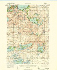
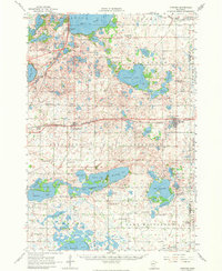
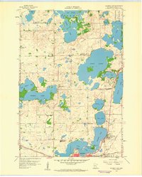
1956 Map of Atwater
USGS Topo · Published 1958About this map
The Great Northern railway forms a central spine through this mid-century landscape, connecting the agricultural hubs of Atwater and Kandiyohi. The area is defined by a dense network of glacial lakes, including the expansive Green Lake and Diamond Lake, which shaped the early development of Spicer. Away from the main rail line, the rural character of townships like Gennessee and Fahlun is preserved through a series of numbered school districts, such as School No 51 and School No 60, and community landmarks like the Town Hall. For genealogists, the map is particularly rich in family history details, noting several rural sanctuaries and burial grounds including Tripolis Ch, Oak Hill Cem, and the St Patricks Cem (Ebenezer Cem). This survey captures the region just as local rural schools remained the cornerstones of their respective sections.
Find a feature on this map
76 named features on this map. Tap any name to fly to it.
Don’t see what you’re looking for? This feature index may not catch every label — zoom into the map to look around manually.
Map Details
Editions of this 1956 Atwater Map
2 editions found
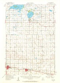
Other maps of this area

1953 · New Ulm
USGS Topo · 1:250,000

1953 · Saint Cloud
USGS Topo · 1:250,000

1957 · Saint Cloud
USGS Topo · 1:250,000

1957 · New Ulm
USGS Topo · 1:250,000
1957 · Olivia
USGS Topo · 1:62,500

1958 · New Ulm
USGS Topo · 1:250,000

1958 · Saint Cloud
USGS Topo · 1:250,000
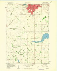
1958 · Willmar
USGS Topo · 1:24,000
1958 · Solomon Lake
USGS Topo · 1:24,000
1965 · Blomkest
USGS Topo · 1:24,000