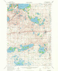
1956 Map of Atwater
USGS Topo · Published 1974About this map
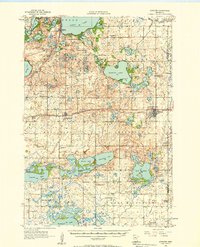
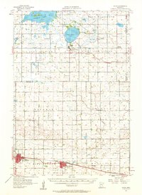
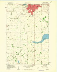
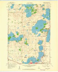
Glacial lakes and small agricultural hubs dominate this mid-century portrait of Kandiyohi County. The massive expanse of Green Lake and the intricate shoreline of Diamond Lake serve as the primary landmarks, surrounded by a dense network of smaller basins like Sperry Lake, Summit Lake, and Lake Elizabeth. The regional economy is anchored by the Burlington Northern railroad, which strings together the settlements of Spicer, Kandiyohi, and Atwater.
Find a feature on this map
81 named features on this map. Tap any name to fly to it.
Don’t see what you’re looking for? This feature index may not catch every label — zoom into the map to look around manually.
Map Details
Editions of this 1956 Atwater Map
2 editions found
Other maps of this area

1953 · New Ulm
USGS Topo · 1:250,000

1953 · Saint Cloud
USGS Topo · 1:250,000
1956 · Atwater
USGS Topo · 1:62,500

1957 · Saint Cloud
USGS Topo · 1:250,000

1957 · New Ulm
USGS Topo · 1:250,000
1957 · Olivia
USGS Topo · 1:62,500

1958 · New Ulm
USGS Topo · 1:250,000

1958 · Saint Cloud
USGS Topo · 1:250,000
1958 · Willmar
USGS Topo · 1:24,000
1958 · Solomon Lake
USGS Topo · 1:24,000