
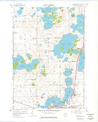
1958 Map of Solomon Lake
USGS Topo · Published 1960About this map
The Willmar city limits and the northern shores of Foot Lake anchor the southern edge of this West Central Minnesota landscape. In the late 1950s, the northern outskirts of the city were defined by significant institutions and infrastructure, including the Willmar State Hospital and a nearby Air Force Station. This survey reveals a transition from the urban grid of the Kandiyohi county seat to a rural township structure of Dovre and Mamre, where the Great Northern railroad cuts across the prairie. The glaciated terrain is dense with water bodies like Long Lake, Solomon Lake, and Ringo Lake, which are interspersed with numerous numbered district schools and local landmarks like the County Fairground and Robbins Island Park. Small country congregations and resting places, such as Solomon Lake Ch and Fairview Cemetery, dot the uplands between the lakes and the Florida Slough Lake.
Find a feature on this map
49 named features on this map. Tap any name to fly to it.
Don’t see what you’re looking for? This feature index may not catch every label — zoom into the map to look around manually.
Map Details
Editions of this 1958 Solomon Lake Map
3 editions found
Other maps of this area

1953 · Saint Cloud
USGS Topo · 1:250,000

1956 · Atwater
USGS Topo · 1:62,500

1957 · Saint Cloud
USGS Topo · 1:250,000

1958 · Saint Cloud
USGS Topo · 1:250,000

1958 · Raymond
USGS Topo · 1:24,000

1958 · Pennock
USGS Topo · 1:24,000

1958 · Willmar
USGS Topo · 1:24,000

1967 · Mount Tom
USGS Topo · 1:24,000

1967 · Sunburg
USGS Topo · 1:24,000
1967 · New London
USGS Topo · 1:24,000