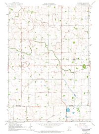
1965 Map of Blomkest
USGS Topo · Published 1966About this map
Blomkest and Roseland sit atop a prairie landscape defined by a sophisticated water management system in the mid-1960s. This agricultural region at the border of Kandiyohi and Renville counties is crisscrossed by an extensive network of drainage channels, including Ditch No 18, Ditch No 8, and the significant Judicial Ditch No 16. The Chicago and North Western railroad forms the central east-west axis of the area, providing a direct link for the local grain economy and serving the Roseland Station.
Find a feature on this map
18 named features on this map. Tap any name to fly to it.
Don’t see what you’re looking for? This feature index may not catch every label — zoom into the map to look around manually.
Map Details
Editions of this 1965 Blomkest Map
This is the sole edition of this map. No revisions or reprints were ever made.
Other maps of this area

1953 · New Ulm
USGS Topo · 1:250,000

1953 · Saint Cloud
USGS Topo · 1:250,000

1956 · Atwater
USGS Topo · 1:62,500

1957 · Saint Cloud
USGS Topo · 1:250,000

1957 · New Ulm
USGS Topo · 1:250,000

1957 · Olivia
USGS Topo · 1:62,500

1958 · New Ulm
USGS Topo · 1:250,000

1958 · Saint Cloud
USGS Topo · 1:250,000

1958 · Raymond
USGS Topo · 1:24,000

1958 · Willmar
USGS Topo · 1:24,000