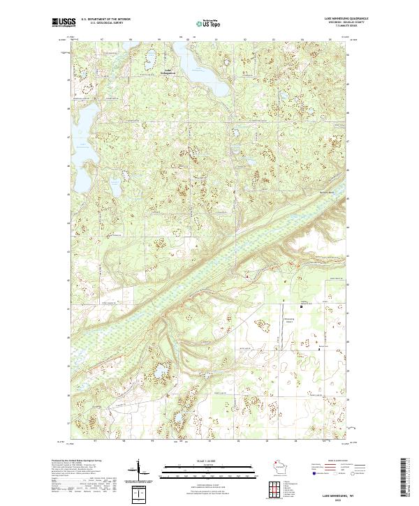
2022 Map of Lake Minnesuing
USGS Topo · Published 2022About this map
The Bois Brule River corridor defines this portion of northern Wisconsin, where numerous spring complexes and tributary creeks feed into the river system. The landscape is dotted with distinct glacial water bodies, from the larger Lake Nebagamon and Lake Minnesuing to smaller, isolated pools like Whisky Lake, Anderson Lake, and Shoberg Lake. This network of water is complemented by significant hydrologic features such as Blue Springs, Beaupre Springs, and McDougal Springs, which suggest a terrain deeply shaped by groundwater discharge.
Find a feature on this map
68 named features on this map. Tap any name to fly to it.
Don’t see what you’re looking for? This feature index may not catch every label — zoom into the map to look around manually.
Map Details
Editions of this 2022 Lake Minnesuing Map
This is the sole edition of this map. No revisions or reprints were ever made.
Other maps of this area

1945 · Highland
USGS Topo · 1:48,000

1945 · Solon Springs
USGS Topo · 1:48,000

1947 · Brule
USGS Topo · 1:48,000

1949 · Solon Springs
USGS Topo · 1:48,000

1949 · Poplar
USGS Topo · 1:48,000

1949 · Highland
USGS Topo · 1:48,000

1953 · Ashland
USGS Topo · 1:250,000

1954 · Lake Nebagamon
USGS Topo · 1:24,000

1954 · Poplar
USGS Topo · 1:24,000

1958 · Ashland
USGS Topo · 1:250,000