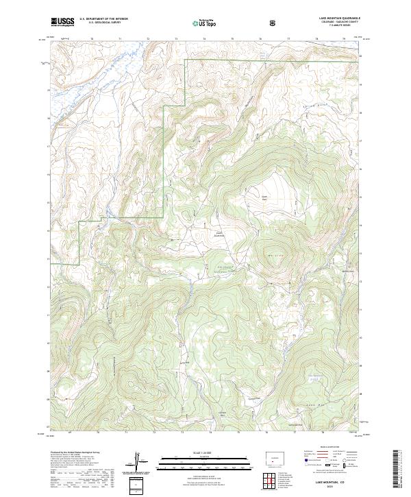
2023 Map of Lake Mountain
USGS Topo · Published 2023About this map
The Rio Grande National Forest dominates this high-altitude landscape in the southern reaches of the La Garita Mountains. The terrain is defined by a series of alpine meadows and clearings known locally as parks, including South Park, Lower South Park, and Sunnyside Park. These open spaces are separated by high ridges and peaks such as Mt Lion and the namesake Lake Mtn, which towers over the southeastern corner of the quadrangle.
Find a feature on this map
32 named features on this map. Tap any name to fly to it.
Don’t see what you’re looking for? This feature index may not catch every label — zoom into the map to look around manually.
Map Details
Editions of this 2023 Lake Mountain Map
This is the sole edition of this map. No revisions or reprints were ever made.
Other maps of this area

1914 · Creede
USGS Topo · 1:125,000

1915 · Del Norte
USGS Topo · 1:125,000

1916 · Creede
USGS Topo · 1:125,000

1917 · Del Norte
USGS Topo · 1:125,000

1945 · Durango
USGS Topo · 1:250,000

1953 · Durango
USGS Topo · 1:250,000

1954 · Durango
USGS Topo · 1:250,000

1956 · Montrose
USGS Topo · 1:250,000

1959 · Montrose
USGS Topo · 1:250,000

1960 · Montrose
USGS Topo · 1:250,000