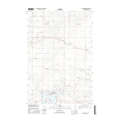
2015 Map of Lake Nebagamon
USGS Topo · Published 2015About this map
Lake Nebagamon serves as the focal point for this Douglas County survey, showing the shoreline development and the network of roads branching from the village core. The northern landscape is shaped by the Tri Co Corridor, a multi-use path that parallels old rail alignments through the communities of Poplar, Maple, and Blueberry. This corridor highlights the transition of the region's transport infrastructure from commercial rail to modern recreational use.
Find a feature on this map
87 named features on this map. Tap any name to fly to it.
Don’t see what you’re looking for? This feature index may not catch every label — zoom into the map to look around manually.
Map Details
Editions of this 2015 Lake Nebagamon Map
This is the sole edition of this map. No revisions or reprints were ever made.
Other maps of this area

1945 · Highland
USGS Topo · 1:48,000

1945 · Solon Springs
USGS Topo · 1:48,000

1947 · Brule
USGS Topo · 1:48,000

1949 · Solon Springs
USGS Topo · 1:48,000

1949 · Poplar
USGS Topo · 1:48,000

1949 · Highland
USGS Topo · 1:48,000

1953 · Ashland
USGS Topo · 1:250,000

1954 · Lake Nebagamon
USGS Topo · 1:24,000

1954 · Poplar NE
USGS Topo · 1:24,000

1954 · Poplar
USGS Topo · 1:24,000