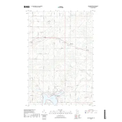
2018 Map of Lake Nebagamon
USGS Topo · Published 2018About this map
Lake Nebagamon anchors the southern landscape of this Douglas County region, serving as a focal point for the surrounding village and nearby smaller water bodies like Minnow Lake and Little Steele Lake. Moving north, the terrain transitions into a more structured grid of rural roads and small communities including Maple, Poplar, and Blueberry. The Tri-Co Corridor cuts an east-west path through these settlements, mirroring the historical transportation patterns that once connected these northern Wisconsin hubs. Genealogists and local historians can trace family-named landmarks such as the Blueberry Cem and several namesake roads like S Ahola Dr and Hendrickson Rd, which hint at the settlement history of the area. The map also delineates the drainage of Nebagamon Creek and Blueberry Cr as they flow through the wetland-rich environment characteristic of the Lake Superior watershed.
Find a feature on this map
83 named features on this map. Tap any name to fly to it.
Don’t see what you’re looking for? This feature index may not catch every label — zoom into the map to look around manually.
Map Details
Editions of this 2018 Lake Nebagamon Map
This is the sole edition of this map. No revisions or reprints were ever made.
Other maps of this area

1945 · Highland
USGS Topo · 1:48,000

1945 · Solon Springs
USGS Topo · 1:48,000

1947 · Brule
USGS Topo · 1:48,000

1949 · Solon Springs
USGS Topo · 1:48,000

1949 · Poplar
USGS Topo · 1:48,000

1949 · Highland
USGS Topo · 1:48,000

1953 · Ashland
USGS Topo · 1:250,000

1954 · Lake Nebagamon
USGS Topo · 1:24,000

1954 · Poplar NE
USGS Topo · 1:24,000

1954 · Poplar
USGS Topo · 1:24,000